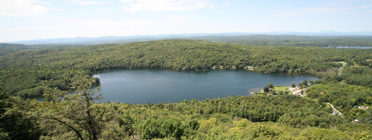
BEEBE POND FROM EAGLE ROCK
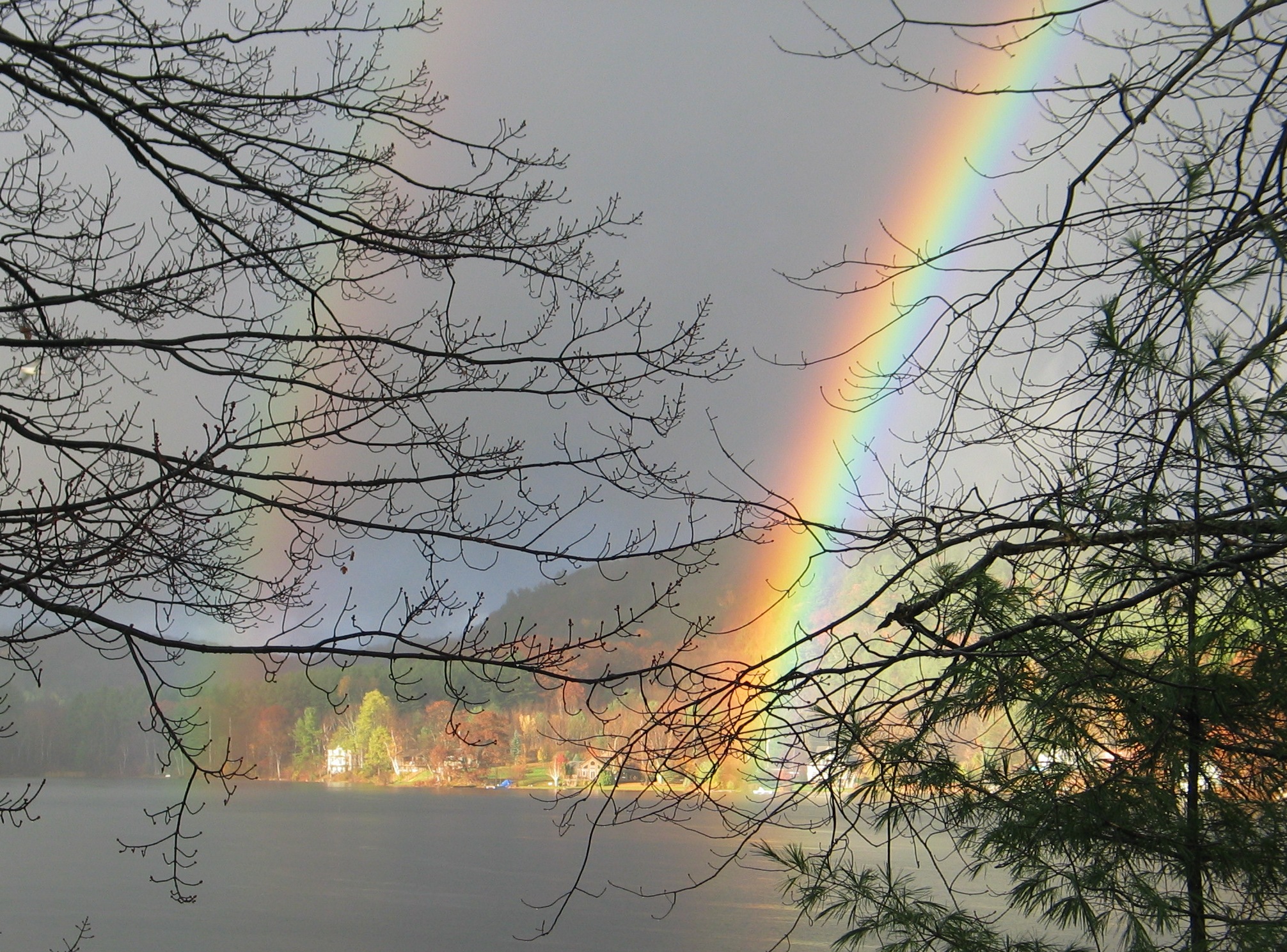
POTS
OF GOLD AT BEEBE POND
Joe Wolons
took this picture on 10/29/2010. Steve Buser found two pots of
Gold on his property!
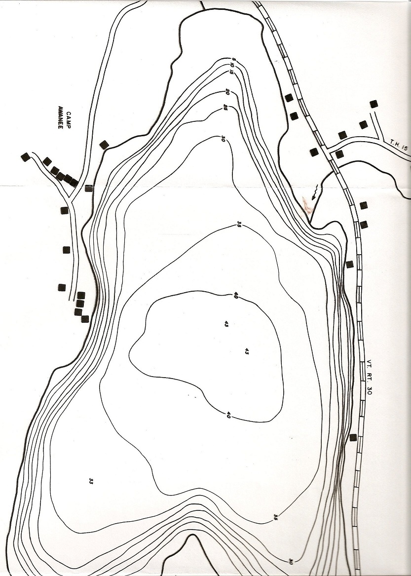
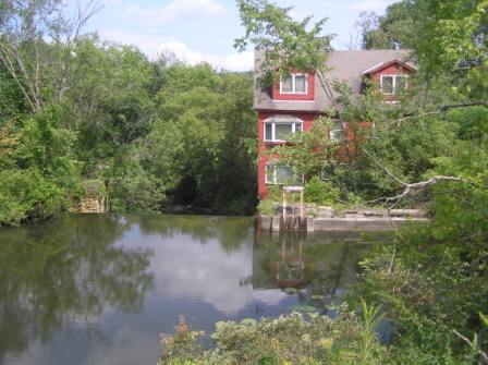
BEEBE POND
Beebe Pond
(Lake Beebe) is a beautiful 110 acre lake located in the Town of
Hubbardton in Rutland County in Vermont. See map
http://www.anr.state.vt.us/dec/waterq/lakes/docs/depthcharts/lp_beebehubb.pdf#zoom=100
The
deepest part is
43 feet deep. Beebe
Pond flows into Austin Pond and then into Lake Bomoseen. Water
from Lake Bomoseen goes through a channel into the Castleton River in
Hydeville. The Castleton River ends at the Poultney River in Fair
Haven. The Poultney River empties into the East Bay of Lake
Champlain, near Whitehall, New York. Here is a
1946 topo.
LAKES AND PONDS AND RIVERS
Statistics on
Vermont Lakes and Ponds:
http://www.voga.org/fish_pond_web.htm Areas are shown in
http://www.vtwaterquality.org/lakes/docs/lp_lakelist.pdf or see
the pdf here.
Vermont has many lakes. In the northern sections of the state
there is the
Lake Memphremagog.
This lake, like Lake Champlain, is shared by Vermont and Canada.
Lake Willoughby
is famous for the beautiful mountains that surround it and for its cold
water fishing. It is one of the deepest lakes in New England.
Lake Bomoseen
is the largest natural lake entirely within Vermont. Bomoseen and
Lake St. Catherine are located just west of Rutland. Both are
favorite summer camping area.
Seymour Lake
is the second largest natural lake in Vermont. Crystal Lake and
Caspian Lake are also beautiful summer resort areas.
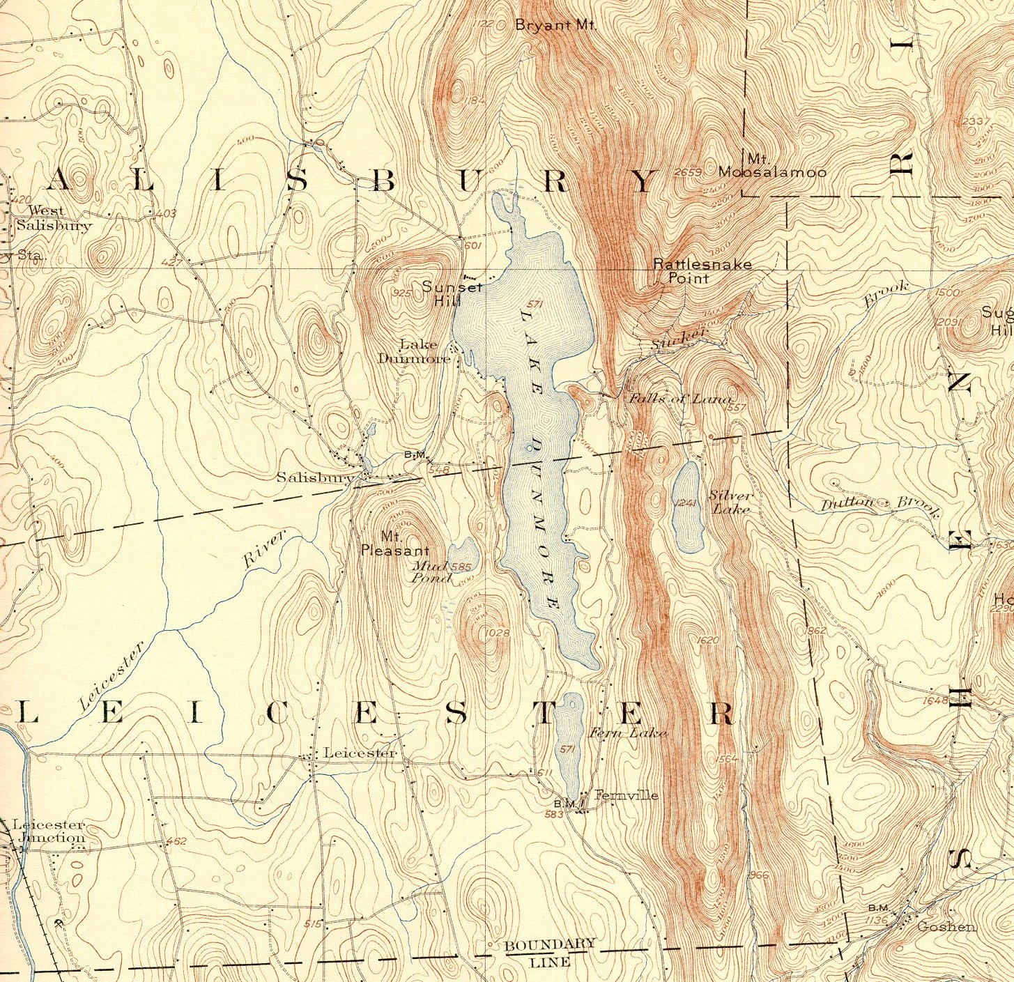
Lake
Dunmore is just northeast of Brandon. It drains into the
Leicester River, which flows west into Otter Creek and then north into
Lake Champlain.
Vermont also has many
reservoirs.
Some of the largest and best known include Waterbury Reservoir in
northern Vermont and Chittenden Reservoir, Somerset Reservoir and
Harriman Reservoir in the southern Green Mountains. Harriman
Reservoir, also known as
Lake Whitingham,
is the largest lake of any kind located entirely within Vermont.
These lakes provide drinking water, electric power, and recreation
opportunities, such as swimming, fishing and boating.

Chittenden Reservoir
Lake Willoughby

Lake Dunmore
Lake Whitingham
Depth Charts of
Lakes and Ponds, see
http://www.vtwaterquality.org/lakes/htm/lp_depthcharts.htm
Data on Vermont
Rivers:
http://en.wikipedia.org/wiki/List_of_rivers_of_Vermont
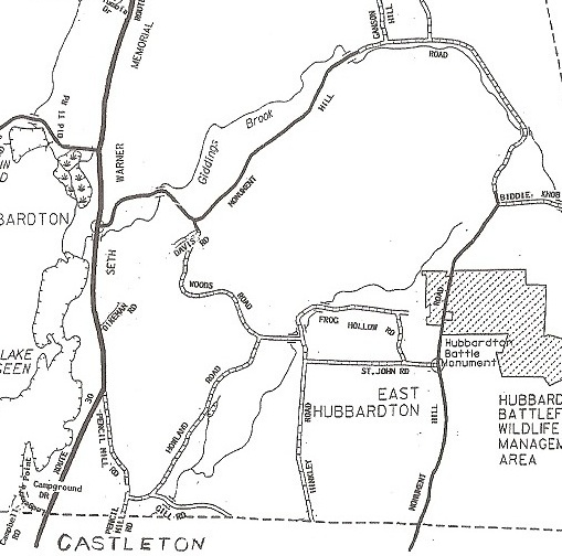
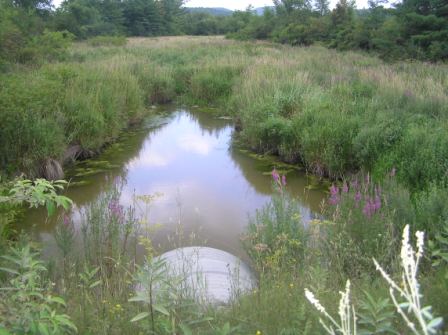
Three major Brooks
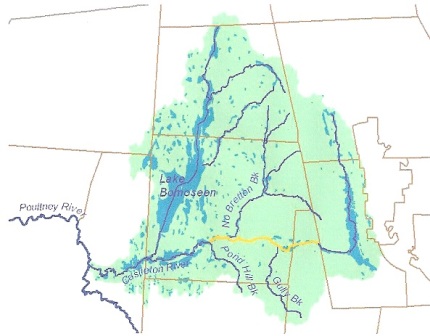
in Hubbardton are Giddings Brook, Sucker Brook, and North Breton Brook.
See map:
http://www.vtwaterquality.org/rivers/docs/SA_SWS/StreamAlterations_Hubbardton.pdf
Click here for more
information on all three brooks and the Pencil Mill Factory.
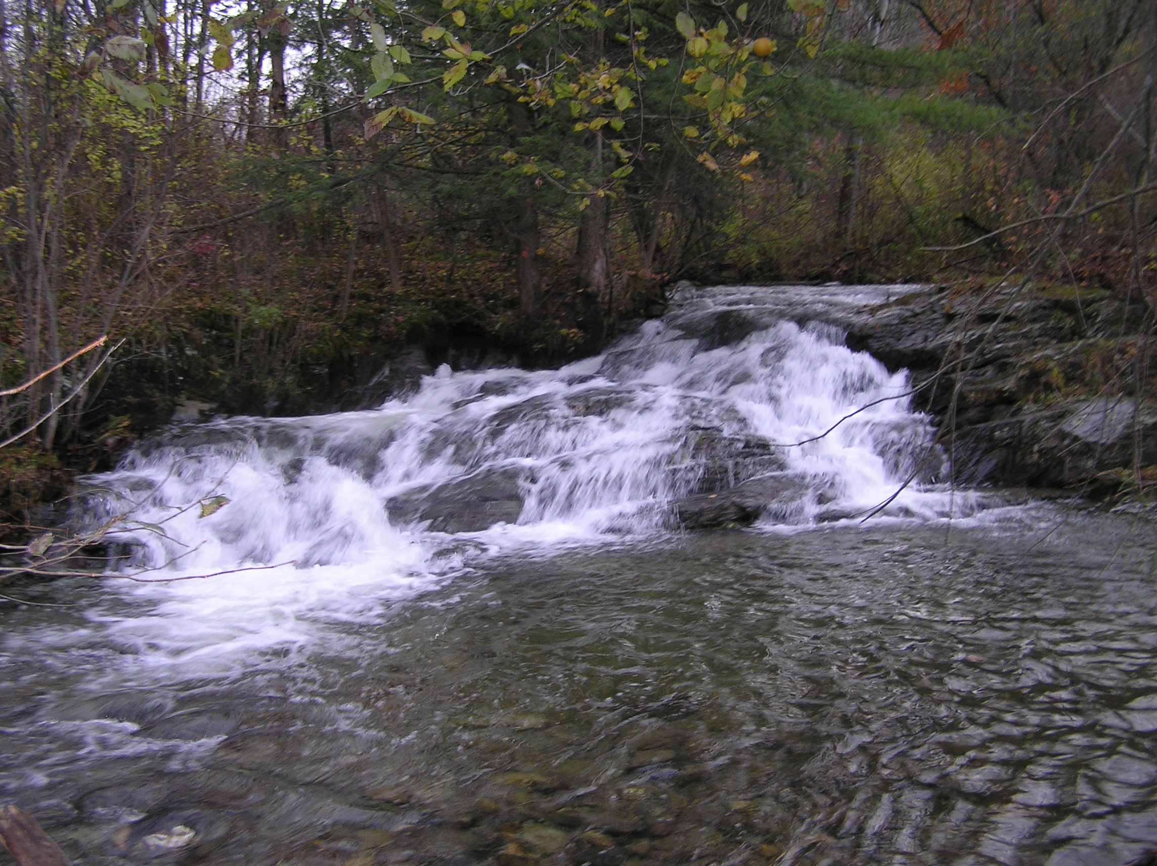
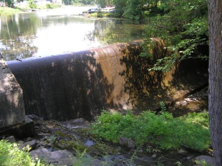
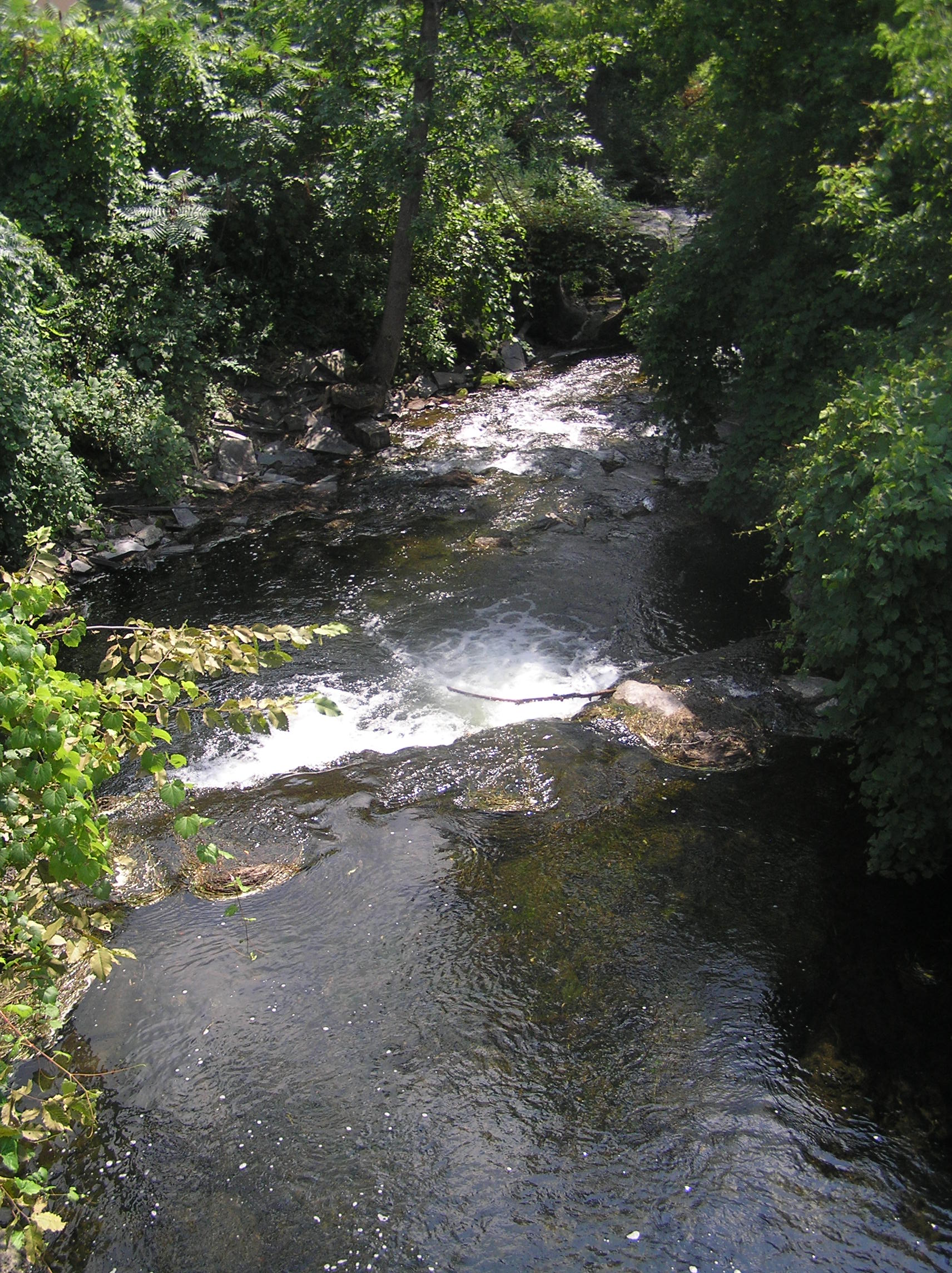
Giddings Brook. It generally follows
Monument Hill Road (MHR). It flows under Monument Hill Road three
times (1. north of Biddie Knob Road, 2. west of the Parsons
School, and 3. an area of cascades about one half mile from Route
30.) It then goes over small waterfalls before flowing under
Route 30 by MHR and then into the north end of Lake Bomoseen.
Dr.Theophilus Flagg, the first physician in town
lived on Frog Hollow Road between the two crossings. You can still see
the stones for the foundation of the Brookside or Flagg School on
the NW corner of Frog Hollow and St John roads west of the brook.
This school house was moved to the corner of MHR and Woods Road.
See Slide Show.
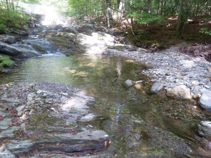
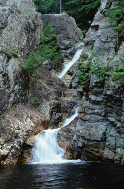
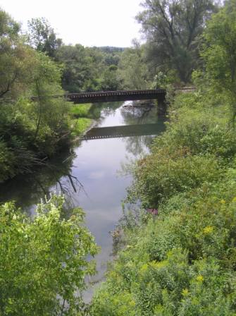
Cascades 1/2 mile from Route 30
Waterfalls near Route 30
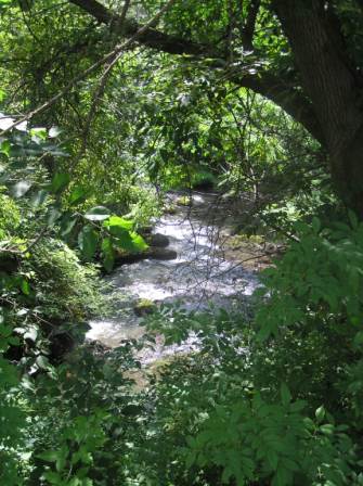
Sucker Brook. It starts below
Biddie Knob Road in the east and flows under a number of roads. In
Hubbardton: 1. Frog Hollow Road twice, 2. St John Road,
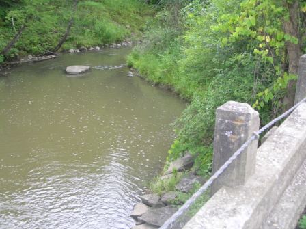
3. Gill Road. In Castleton: 1. Stables Road, 2. North
Road and 3. Route 30 past Crystal Beach and into Lake Bomoseen. It
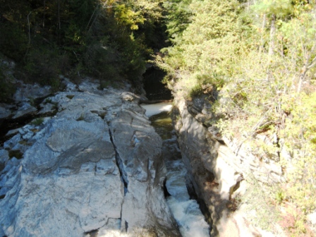
carved out a beautiful gorge south of Gill Road. A pencil mill factory,
which used slate for pencils, was located on Sucker Brook north of
the Pencil Mill Schoolhouse on Stables Road. The Battle of Hubbardton
started near Sucker Brook in East Hubbardton. This brook ends at Lake
Bomoseen in Castleton. See Slide
Show.
%20School%20Property.jpg)
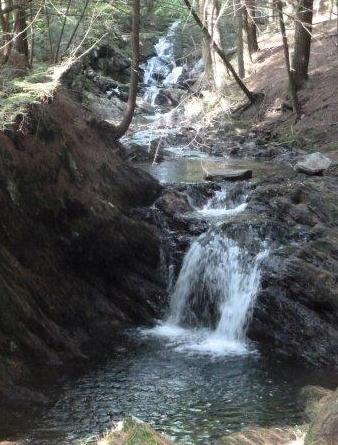
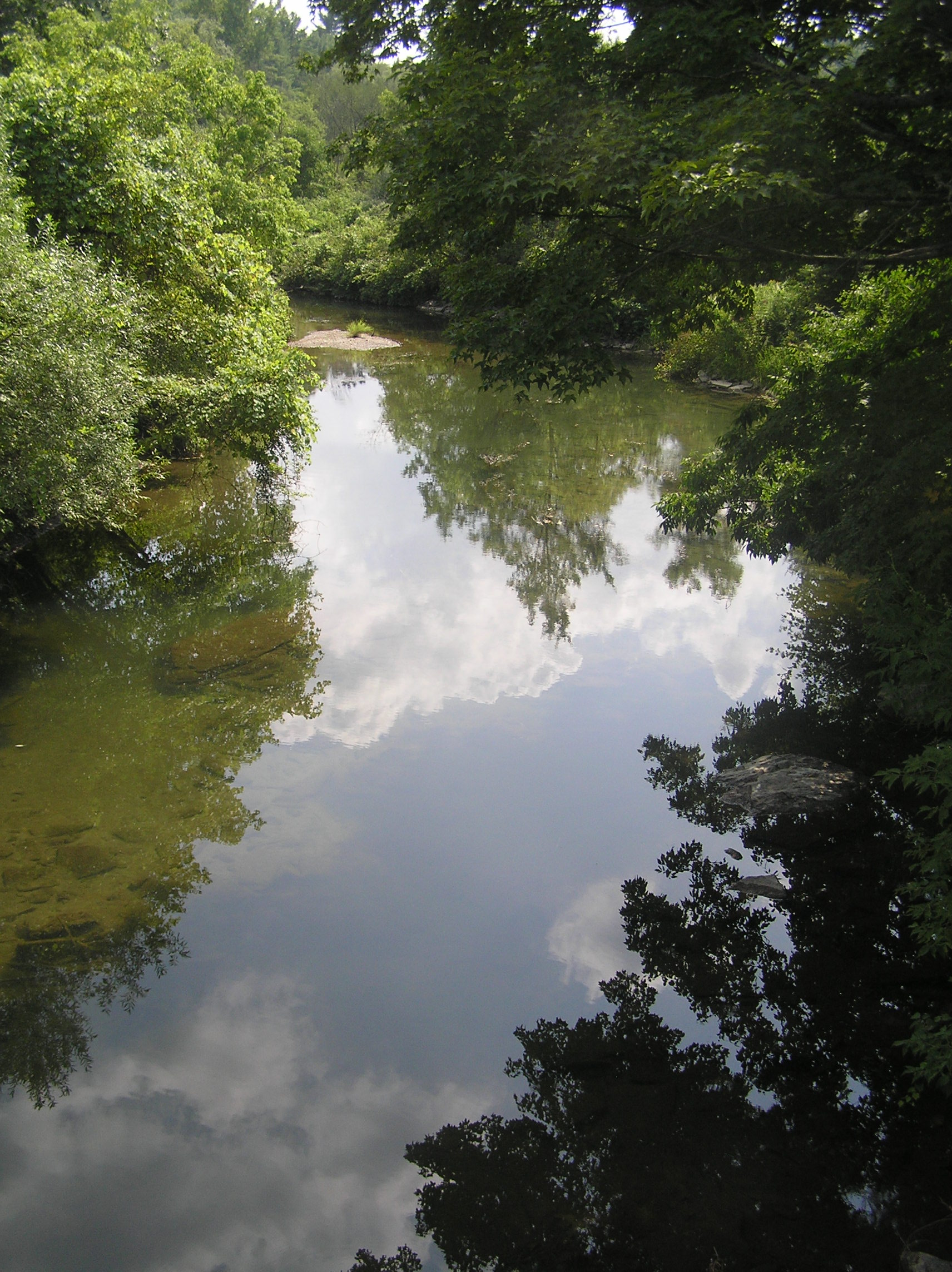
View west towards former Brookside School Property Gorge, just south of Gill Road
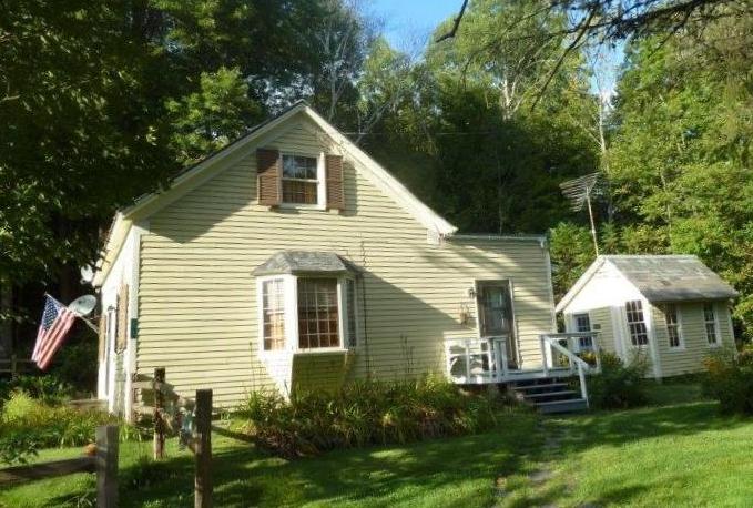
Former Pencil Mill
Schoolhouse on Stables Road
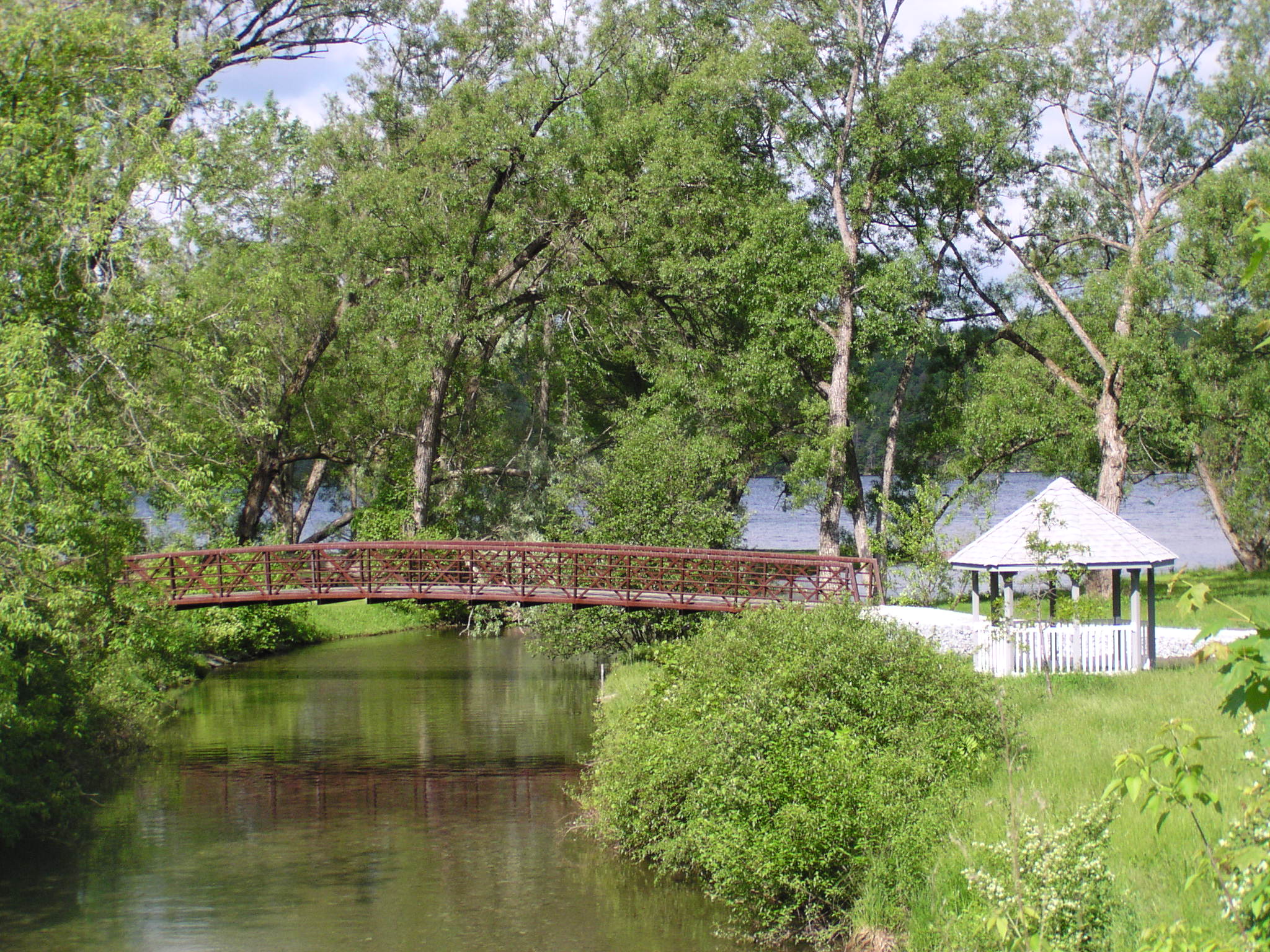
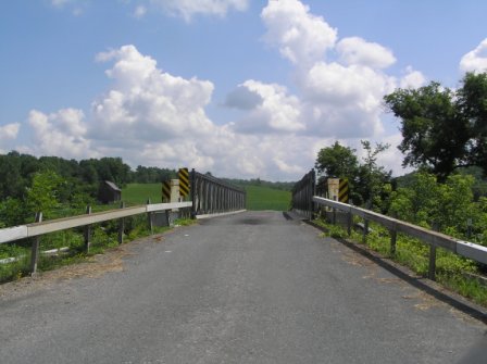
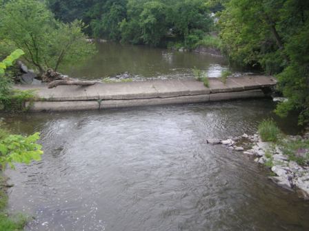
Bridge at Crystal Beach on Lake Bomoseen
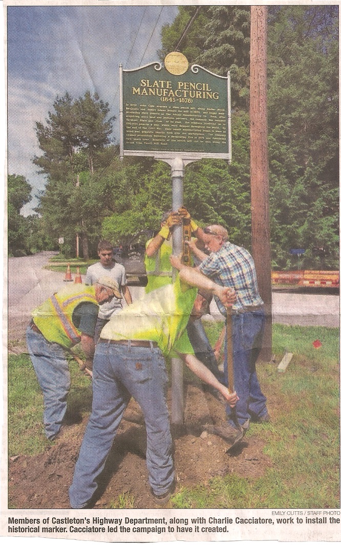
Also read the article in Rutland Herald about Fair Haven High School
graduate Charlie Cacciatore getting the above
Pencil Mill Historical Marker erected. Charlie lives on Pencil
Mill Road in Hubbardton and will be a Freshman at Middlebury College
in September 2016.
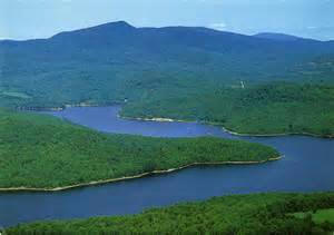
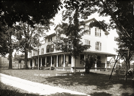
LAKE BOMOSEEN
Lake Bomoseen is to
the south of Beebe Pond. It is the largest lake within the borders
of Vermont of almost 2400 acres. It has a maximum depth of 65
feet. A small part is in Hubbardton and a larger part is in
Castleton.
In 1999, History students at Castleton State College wrote an excellent
book titled
Beautiful Lake
Bomoseen. Professor Dennis Shramek edited that book which
described the many hotels on this lake, a dance pavilion, and trolley
service from Rutland.
The Trakenseen was one
of the oldest hotels. Karen Sondergeld worked there as a waitress one
summer.
Neshobe Island , also
called Taghkannuc and Kellowanda
was named Neshobe at a celebration on July 4, 1881. Alexander
Woollcott owned the island for many years. He gave money to the
Library in Castleton, which is why
his picture adorns the east wall.
The book includes stories about the members of the famous Round Table at
the Algonquin Hotel who visited Neshobe Island, including
Dorothy Rothschild Parker. Some of her wit includes:
“Men seldom make passes at girls who wear glasses.”
"You can lead a horticulture, but you can't make her think."
."Tell him I was too fucking busy - or vice versa". Davene and Jerry
Brown, the current owners of Neshobe Island, completed
their new home on Lake
Bomoseen in 2010. It is on the west side of Route 30 north of the
church.
In 2009 a new book
was written by Donald Thompson, titled
"Lake
Bomoseen: The Story of Vermont's Largest Little-Known Lake".
It is also well worth reading.
Water ski on Lake
Bomoseen: You can rent a ski boat for waterskiing or a
pontoon boat for touring at Woodard Marina (802-265-3690). Lake
Bomoseen flows into the Castleton River.
Julio Buel often
rode his horse to Lake Bomoseen in Vermont to fish. In 1830, during one
of those trips, he took a break to eat his lunch. As he turned around to
get it, he accidentally knocked a table spoon packed in the lunch
overboard. As he was watching the spoon slowly sink to the bottom, a big
bass swam up and hit it several times. The excited angler decided
to take another spoon from the kitchen, attach a hook on the concave
side of it, and trimmed and drilled a hole in the handle for the fish
line to be tied. He then tested his new idea on the next fishing trip to
the lake and caught several nice-sized bass with it. People asked
him to make some spoon lures for them and that was the beginning of the
Julio T. Buel Bait Company. See the
History of the
spoon lure.
See pictures of
the lake at:
http://www.cardcow.com/c/67239/vermont-lake-bomoseen/


LAKE HORTONIA
Lake Hortonia is a 479 acre lake
north of Lake Bomoseen. It has a maximum depth of 60 feet.
Half of the lake is in Hubbardton and half is in Sudbury.
There was a large inn in Sudbury on
Route 30 (
The
Hortonia) and a
dance pavilion nearby.
The beautiful log home on Walker Grove Road on the site of the dance
pavilion was
still for sale on July
1, 2010.
The outlet from Lake Hortonia is the Hubbardton River.
http://www.vtwaterquality.org/lakes/docs/depthcharts/lp_hortonia.pdf#zoom=100
LAKE GEORGE (One of the best in the US) (Not in Vermont, but is
close by)
Drive to Hulett's Landing on the east side of Lake George and camp
on one of the islands. That is a terrific experience on one of the
nicest lakes in the US. We have spent many days camping on the
beautiful state owned islands.
See:
http://www.dec.ny.gov/outdoor/24474.html
and
http://www.lakegeorge.com/guide/island-camping.cfm and
http://www.lakegeorgeguide.com/regional-area-info/did-youknow/
Hiking:
http://www.lakegeorge.com/hiking.cfm
Drive to the west side and take a cruise. See:
http://www.lakegeorgesteamboat.com/
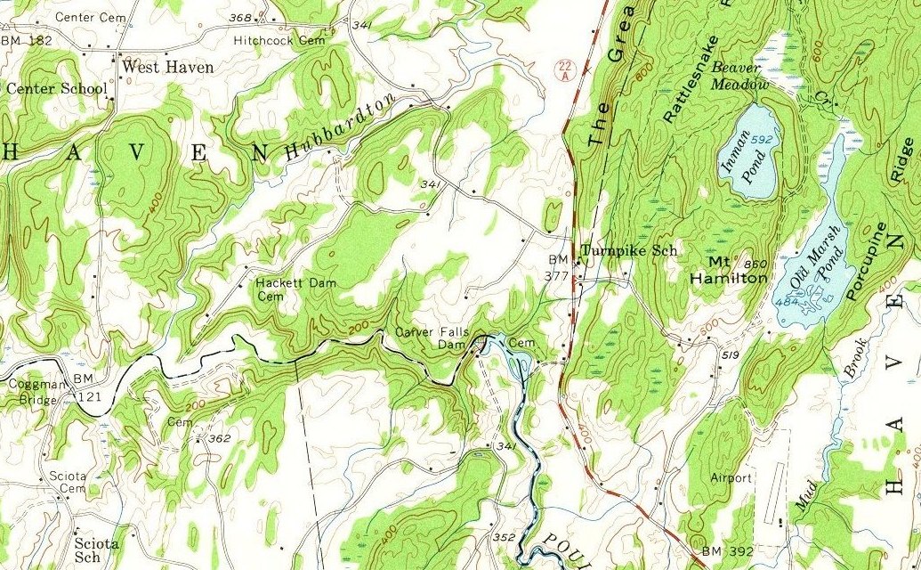
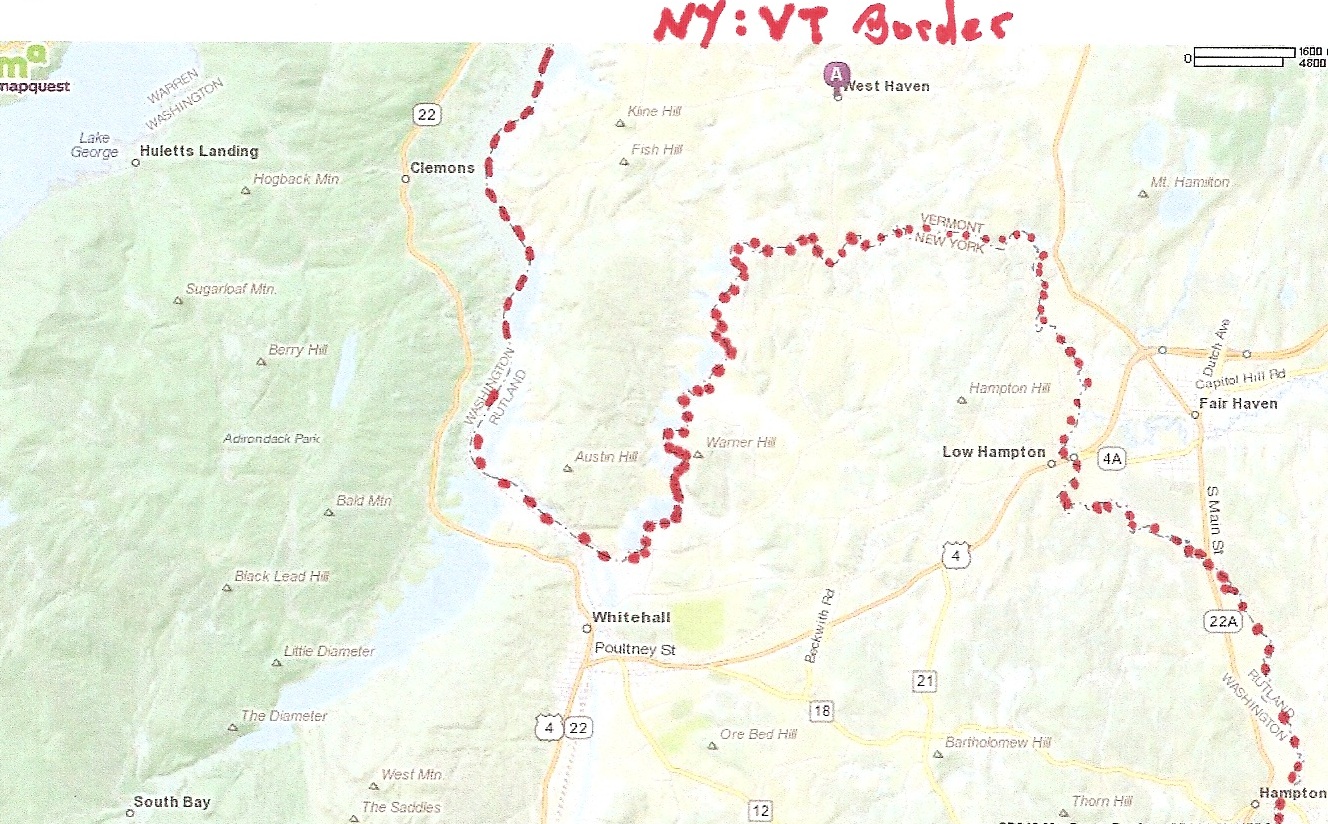
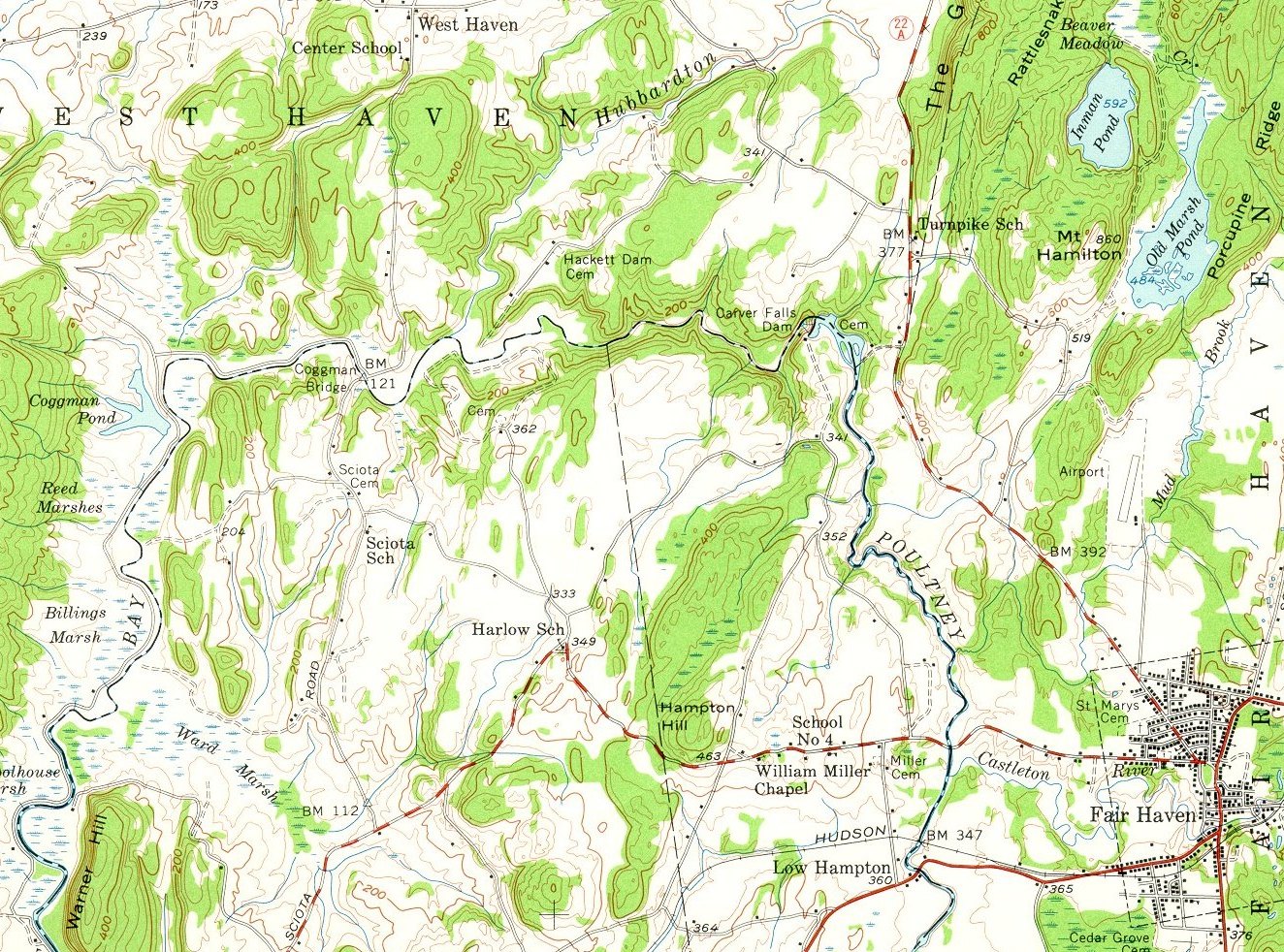
HUBBARDTON
RIVER
The 20 mile long
river begins at Lake Hortonia. This river flows SW though Benson and
West Haven and then joins the Poultney River. There are at least
four tributaries that flow into the river that starts at the outlet from
Lake Hortonia in Hubbardton.
See Map.
Another map is at
http://www.anr.state.vt.us/dec//waterq/rivers/docs/FinalReports/rv_A_HubbardtonRiverDebris.pdf
a) The river begins
at
the dam at the outlet
from Lake Hortonia. It flows west, then south and then west
under Route 144 (the road to Benson) 1.4 miles from the dam, where
there is a falls on the west side of Route 144. Shortly thereafter
it is joined by a
small tributary from
the north, which you can see if you drive north on Pleasant Valley Road.
b) The Hubbardton
River continues west to the northeast corner of Rout 144 and
Sunset Lake Road, which is 2.8 miles from the Hortonia dam.
Shortly before this point it is joined by another tributary, the outlet
from Sunrise Lake that flows down from the north.
c) The river then
flows west
under Sunset Lake Road,
.1 mile north of Route 144.. Then it flows .2 mile
west along Route 144 and turns south
under Route 144 and
continues south to the dam at
Mill Pond. The outlet to Mill
Pond flows southeast along the north side of Mill Pond Road.
c) After it leaves
Mill Pond, it is almost immediately joined by another tributary that
flows south from Howard Hill. This tributary comes from Bresee Pond and
from Black Pond. The river flows south
under Mill Pond Road.
It continues southwest and flows
under Route 22A a half
mile north of East Road. Just west of Route 22A it is joined by
another tributary (Beaver Brook) that flows down from Strong Swamp west
of the center of Benson.
d) It continues
about 3 miles or more and goes
under Main Road in
West Haven. It flows southwest along the west side of River
Road for about 2 miles. Half way down River Road there is a lovely
set of rapids. It
then enters the Poultney River just east of the
Coggman Bridge. This
bridge is 2.1 miles south of West Haven on Book Road, which becomes
Route 10 in New York. (If you want to canoe in this area, turn west onto
the dirt road just before the bridge on the Vermont side. Travel on the
dirt road for 1.1 miles until you arrive at Coggman Creek culvert, where
the creek empties into the Poultney River. This is the canoe put-in.
Limited roadside parking is available.)
The confluence of
the
Hubbardton River with
the Poultney River can be seen by walking east from Book Road before
reaching the Coggman Bridge. Alternatively, it can be
seen by driving to the end of Hackadam Road from Main Road in West Haven
and then walking in about one mile to Nature Conservancy property.
Don't park in the area labeled parking, but farther down the road, about
three houses from the end at Sam Ezzo's and then walk in the
dotted lined road.
See
topo of the area.
In 1792 it was
decided to separate West Haven from Fair Haven. One proposal
for the dividing line was the Hubbardton River which enters the Poultney
River just east of the Cogman bridge. Another proposal was Mud
Brook, which also flows into the Poultney River, just north of where the
Castleton River flows into the Poultney River. Mud Brook
lies east of Inman Pond, the reservoir that supplies water to Fair
Haven. Mud Brook starts near Old Marsh Pond.
Old Marsh Pond is south
of Glen Lake in the northeast corner of Fair Haven. (Glen Lake
lies in three towns: Fair Haven, Castleton, and Benson.) The compromise
was a vertical line just east of Route 22A along The Great Ledge.
The two towns shared one representative until 1823 when each had one.
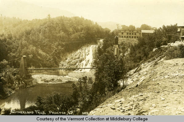
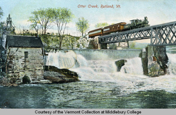
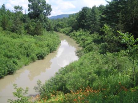
CASTLETON
RIVER
The Castleton River
Basin is comprised of fifty-four subwatersheds covering approximately
ninety-nine square miles. It covers all of the town of Castleton and
portions of the towns of Fair Haven, Hubbardton, Pittsford, Proctor,
West Rutland, Ira and Poultney. It includes Lake Bomoseen, Glen Lake,
Pine Pond, and several other smaller ponds. The major tributaries are
Pond Hill Brook, North Breton Brook ,and Gully Brook. The minor
tributaries are Belgo Brook and two unnamed tributaries to North Breton
Brook. Many projects are on going. See the Gully Brook Project at:
http://www.pmnrcd.org/projects/district_projects/castleton_river_restoration.php
Read the excellent
report about the
Castleton River.
It begins in the marshes of
Whipple Hollow above West Rutland and
flows 20 miles to the Poultney River west of Fair Haven. See
SLIDE SHOW.
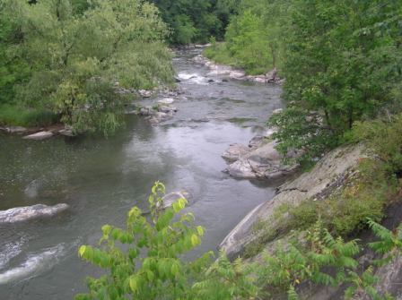
The river flows
under many roads on its
westward journey to the Poultney River. In Castleton, you can see
it where it flows under Mill Street, North Road, and Cemetery
Road. It then goes
under Route 4A east of
Castleton Corners before flowing under
Route 30 south of
Castleton Corners. It flows under the
Blissville Road 3/10 of
a mile south of The Dog in Hydeville. The
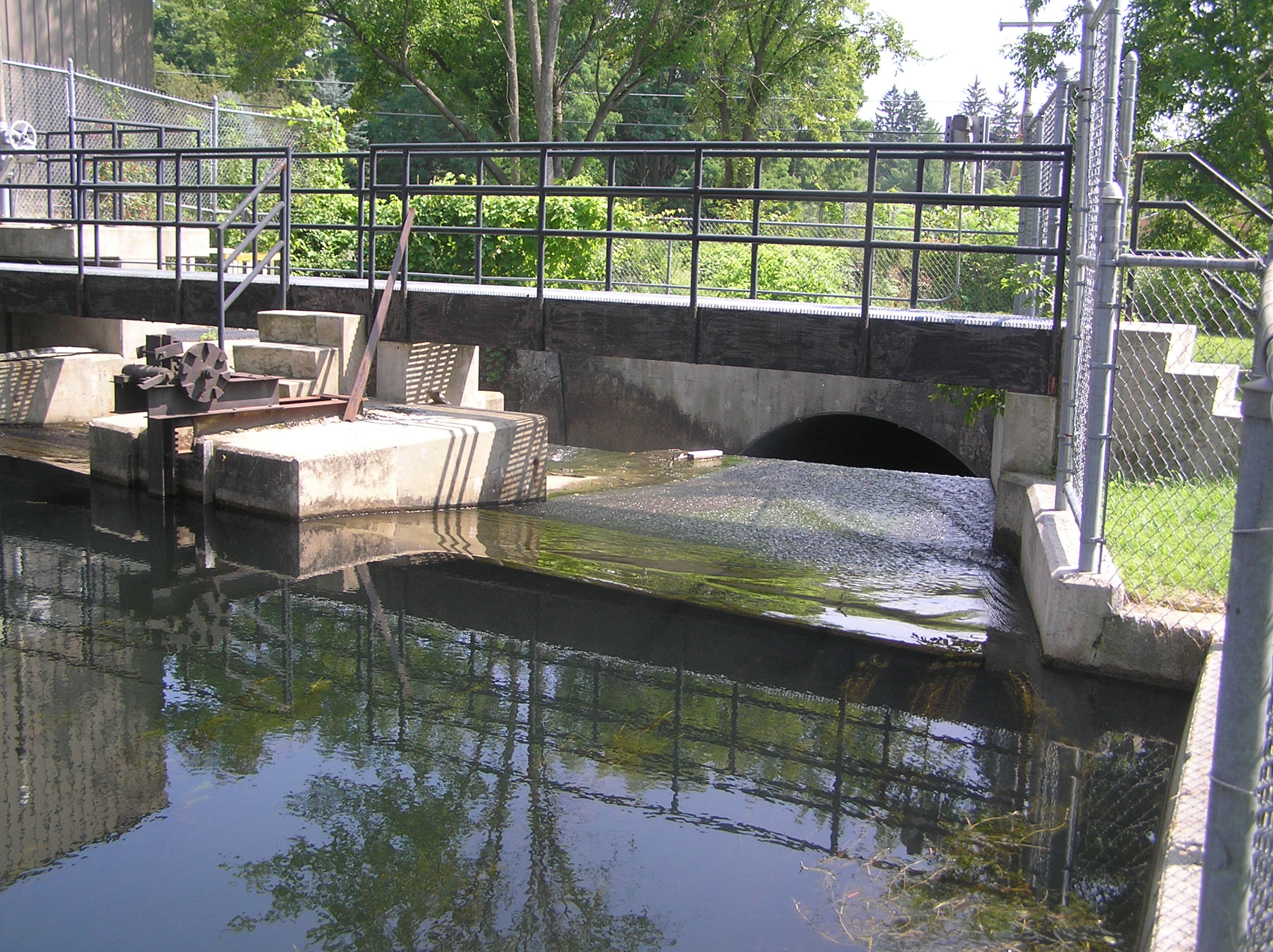
outlet from Lake Bomoseen
is a dam on the north side of Route 4 in Hydeville. The water from
Bomoseen then
flows a little south
under Route 4A and turns west and meets the Castleton River less than a
half mile west of Hydeville.
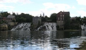
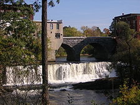
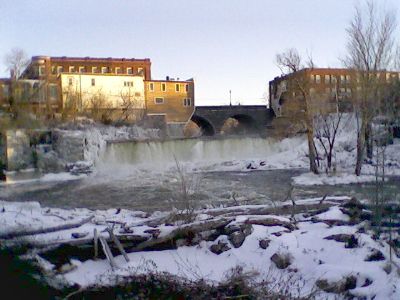
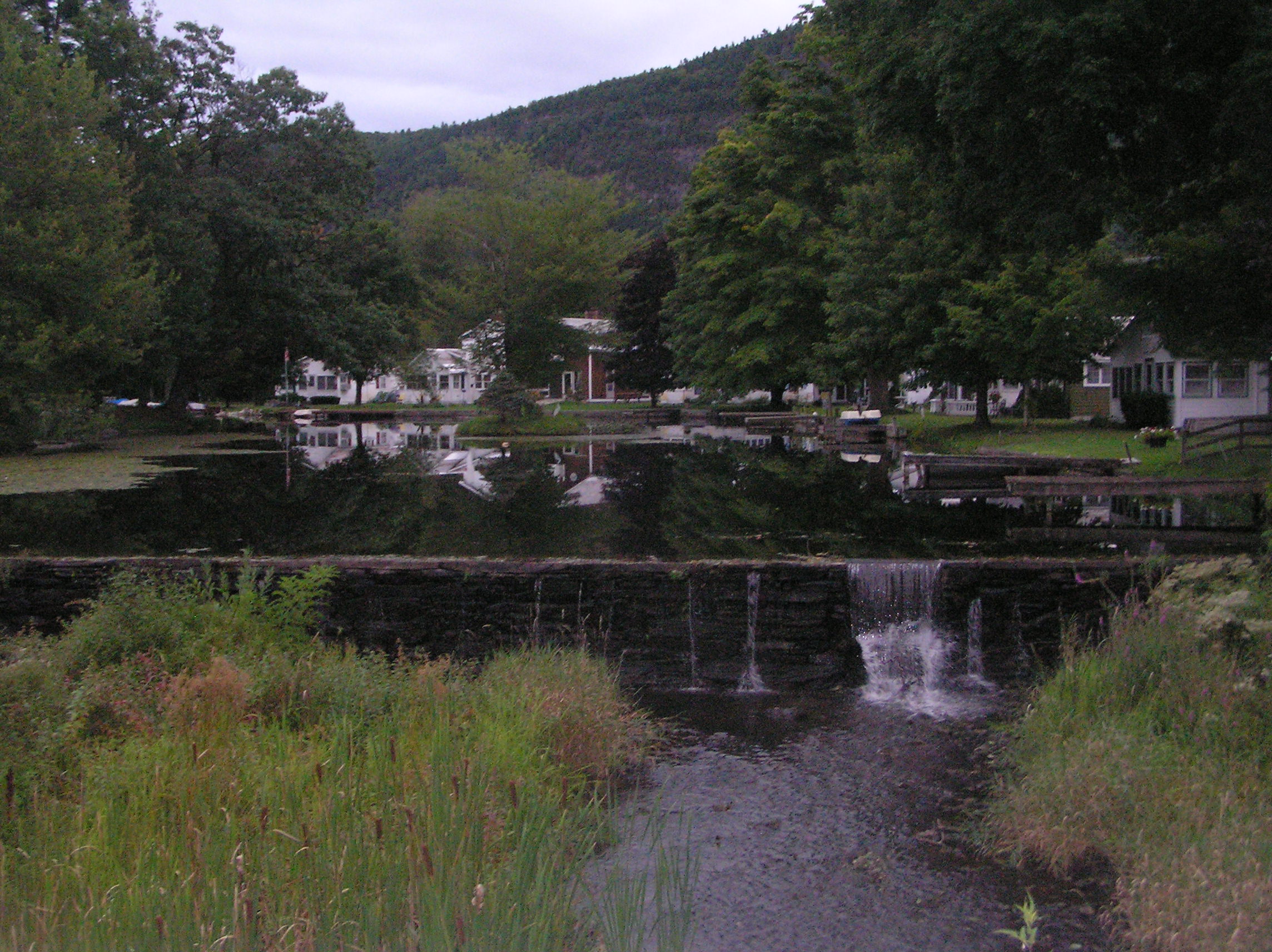
In Fair Haven we
view the river
at the corner of Route
4A and Route 22A. On Adams Street, just south of the Fair
Haven Inn, there are waterfalls. They are shown below:
The river then
flows under the
Route 4 divided highway.
The Castleton River empties into the Poultney River just south of
the West Street bridge over the Poultney River. The Poultney River then
empties into the East Bay of Lake Champlain in Whitehall, New York.
See map below of where the
Castleton River joins the Poultney River in Fair Haven. The Poultney
River then wiggles its way to Lake Champlain.
POULTNEY
RIVER (and Mettewee River below)
The 40 mile long
Poultney River starts on the west facing slope of Tinmouth Mountain near
Middletown Springs and flows west to Poultney where it turns north.
Just west of Poultney, it forms the
boundary between Vermont and New York.
This river flows north
under Route 4
just west of Fair Haven, Vermont. It then flows under the
bridge on West Street
in Fair Haven. It continues north to West Haven. It turns west near
Carver Falls and then turns south past the Coggman Bridge. It continues
south and west and empties into the
East Bay of Lake Champlain near Whitehall,
NY.
The Poultney River
basin includes the Castleton River and the Hubbardton River.
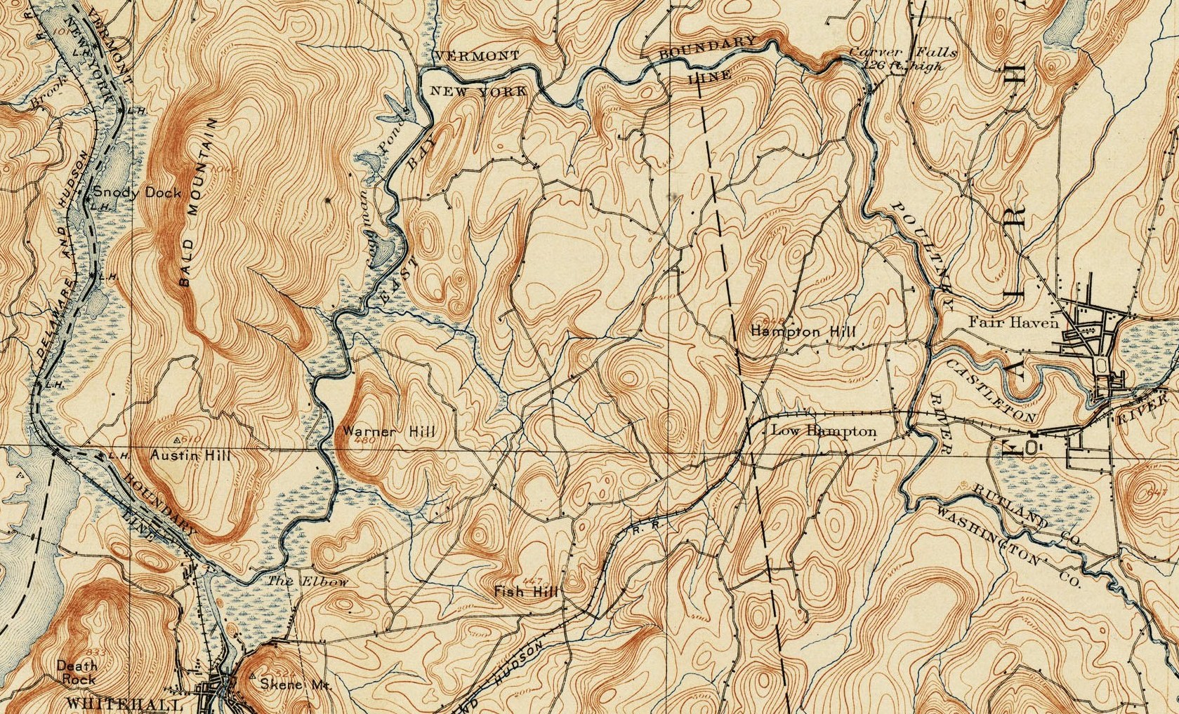
In the History of
Fair Haven (and and later West Haven) we read: "There are traces
still existing confirmatory of early indirect records, that a body of
Hessian soldiers came up the East Bay during the war, and abandoning
their boats at the foot of "Carvers Falls, " cut a road thence through
the woods on the New York side, to Poultney River at a point a little
below its junction with the Castleton River (Not the Castleton River,
should be Hubbardton River), at the south end of the old Merritt
farm, where they threw over a bridge long afterward known and called the
" Hessian bridge, " over which they crossed the river and cleared a road
eastward toward Castleton and Hubbardton by way of the large hill south
of Hiram Hamilton's, which, on account of their hollowing out a stump on
the top of the hill was called "Hessian Bowl Hill." By this " Hessian
Road, " where it came away from the river, the surveys and deeds of Mr.
Merritt's farm were afterwards bounded. Another detachment of
Burgoyne's army passed through this town after the battle of
Hubbardton, in July, 1777, and it is thought made a road south of the
river, passing near Otis Eddy's, and along the north side of the cedar
swamp below J. W. Estey's house and thence crossing the Poultney river
S. and W. either creating or following what was Iong subsequently known
as Skeene's road. On a rude map of this region, printed in London,
in January, 1779, by order of Governor Wm. Tryon, of New York, there are
two roads branching out of the east of this town, and diverging S.
W. across the territory of Gen. Skeene."
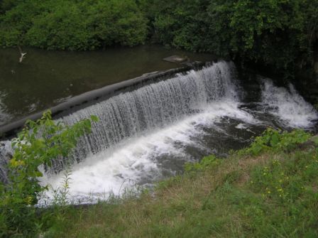
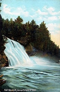
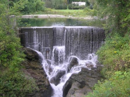
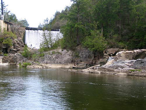
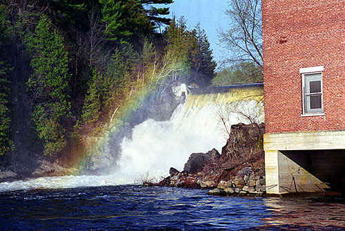
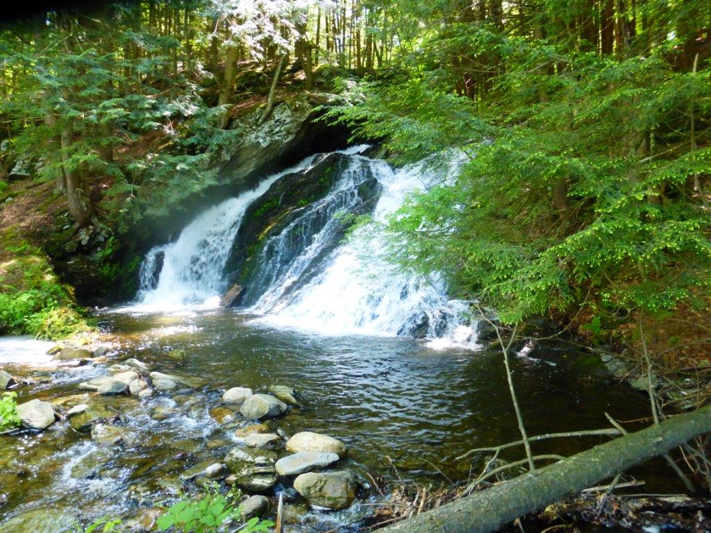
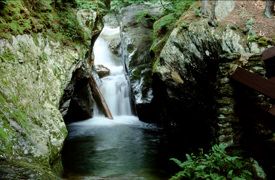
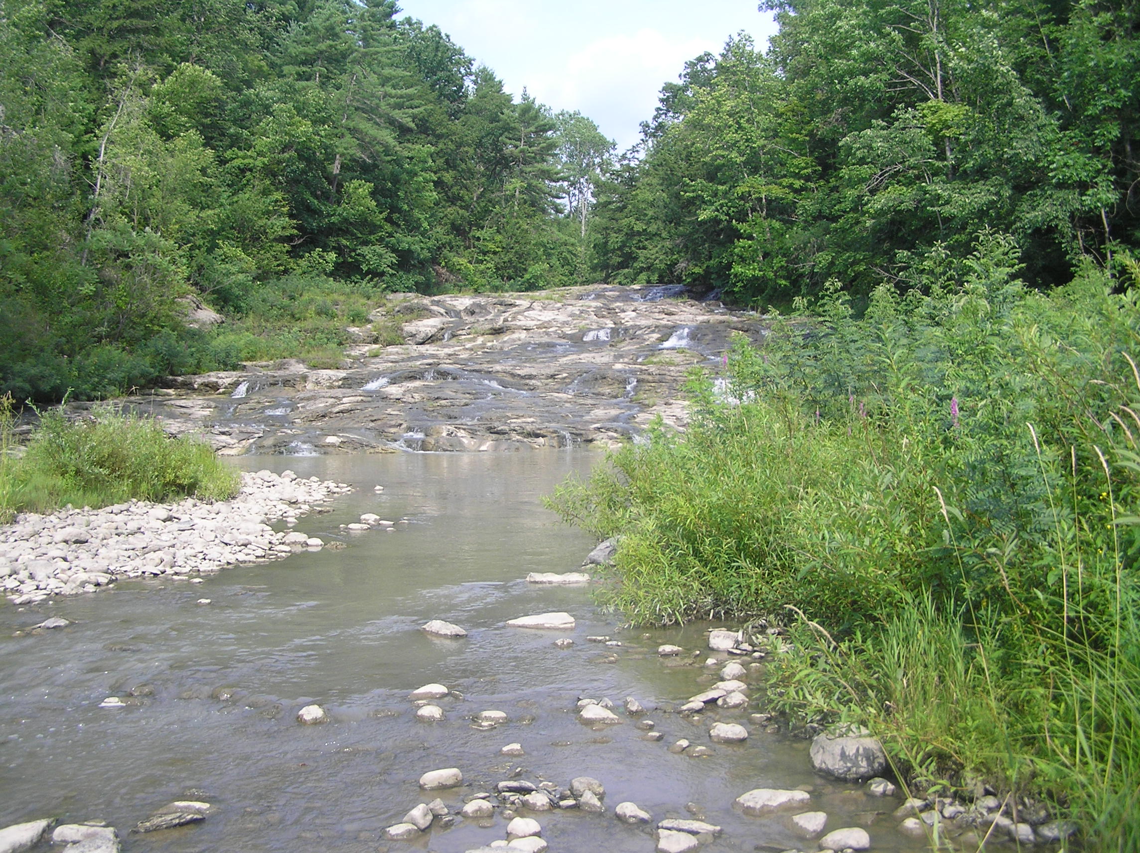
CARVER FALLS
ON THE POULTNEY RIVER
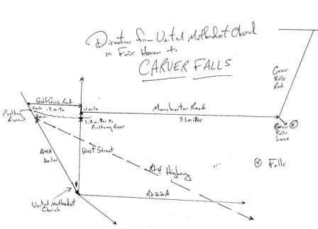
Carver Falls is on
the Poultney River about 6 miles northwest of Fair Haven, VT. It
is 126 feet high. To get there, drive
west on West Street
in Fair Haven. (West street begins by the
United Methodist Church on the northeast corner of the Town Green and
Route 22A) After 1.5 miles turn right (north) on Manchester Road.
After 3.3 miles, turn right on Carver Falls Lane. (Do not turn
left on Carver Falls Road) Park at the dead end in one half
mile. To view the falls, walk down a wooden stairs and turn right, or
hike down the embankment at the left land corner of the fence that
encircles the
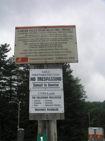
CVPS facility.
See
topo of the area.
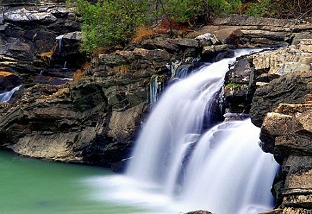
The following picture of Carver Falls was taken on
July 10, 2010.
See canoeing to Carver's Falls
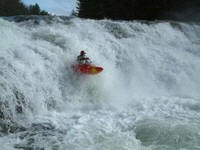
http://www.americanwhitewater.org/content/River/detail/id/3984/

www.northeastwaterfalls.com/waterfall.php?num=62&p=0w
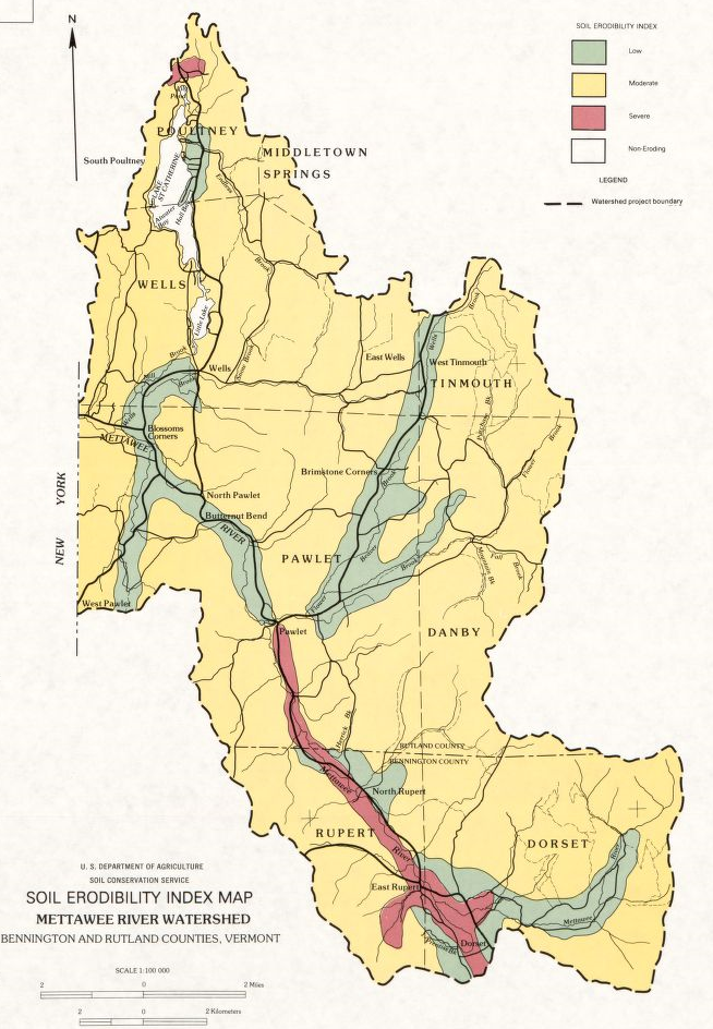
The Poultney and Mettawee Rivers Basin (Basin 2) is
located in the southwestern portion of the state and covers 373 square
miles in Vermont within the counties of Addison, Rutland and Bennington.
The majority of the basin area lies in Rutland County.
The Poultney River originates in Vermont and flows westerly to the New
York border and then as the border between Vermont and New York state,
it makes an arc (north,west, then south) and enters South Bay of Lake
Champlain near Whitehall, New York. The Castleton River is a major
tributary of the Poultney River.
The Mettawee River begins in the hills of Dorset, flows northwesterly
within Vermont into New York state, and joins the Poultney River via the
Champlain Barge Canal near Whitehall, New York. The Indian River, which
originates in Vermont, joins the Mettawee River at Granville, New York.
METTEWEE RIVER VALLEY
The 40 mile drive from Beebe Pond to
Dorset is lovely. The last part goes through the beautiful Taconic
Mountains in the Mettewee River Vallley. The Mettewee River begins
south of Dorset and flows north for 17 miles in Vermont to the New York
border near Granville (through Dorset, East Rupert, North Rupert, and
Pawlet). It crosses into New York and goes through Granville, Middle
Granville, Raceville, West Granville and then into the Champlain Canal
south of Whitehall. The
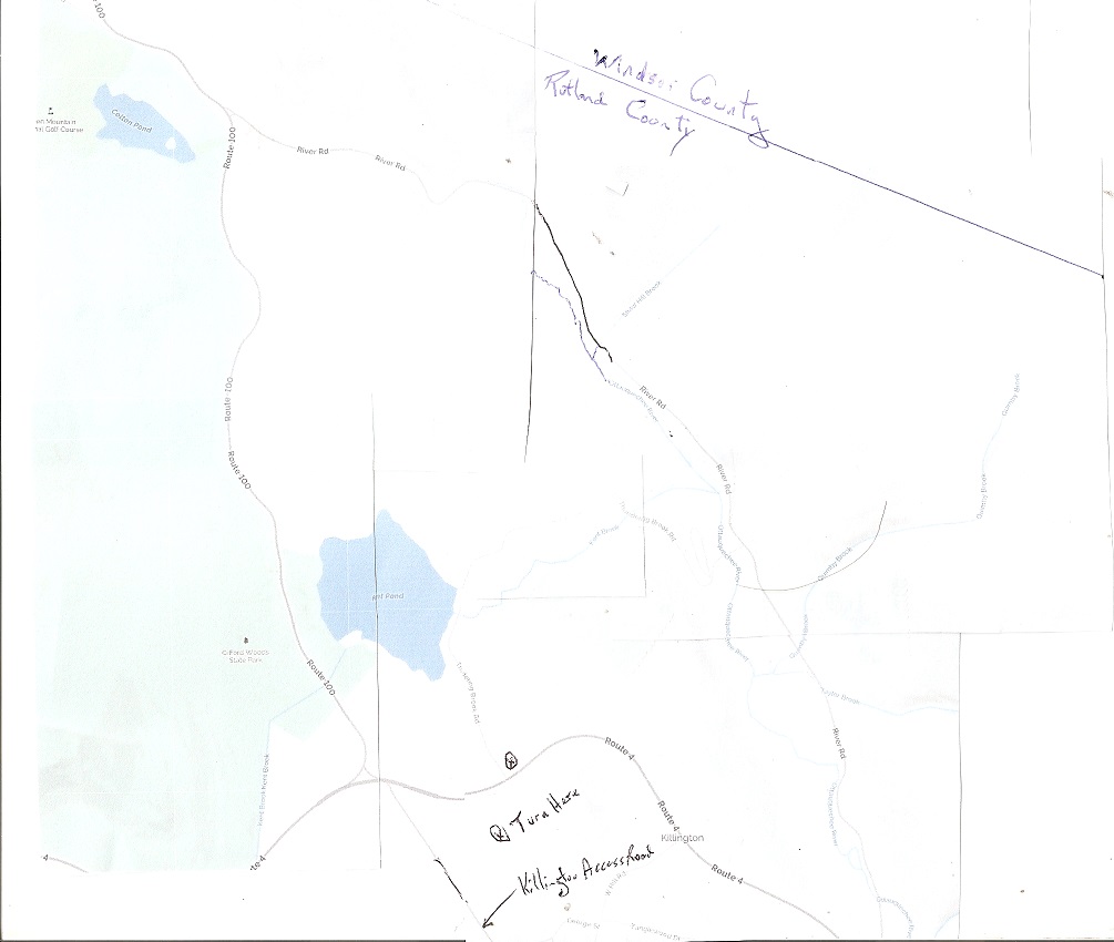
From the junction of Route 7 and 4 in Rutland, take Route 4 east for
11.2 miles to Thundering Brook Road to Kent Pond and turn north. Follow Thundering
Brook Road along the edge of Kent Pond and then steeply down hill to the
bridge over Thundering Brook in 1.3 miles and park. Find where the blue
blaze marked trail descends down the hill on the south side of
Thundering Brook and follow steeply downstream to the various vistas of
the falls and finally to a viewing deck at the base of the falls, just
off of the Appalachian Trail. To view the upper tiers of the falls, some
steep off-trail scrambling along the side of the falls is required.
See Map.
Locals also know this waterfall as Bakers Falls. Thundering Brook
is the outlet of Kent Pond.
The Green Mountain Club, the Appalachian Trail Conservancy, the National
Park Service, and Green Mountain National Forest have worked on this
project since the mid-1980s. Major funding was secured and work began in
2005.Thundering Falls provides the first universal accessible portion of
the Appalachian Trail in Vermont with wheelchair accessible parking on
River Road in Killington.
Thundering Falls is said to be the sixth tallest waterfall in Vermont.
It is part of Kent Brook which flows out of Kent Pond just north of
where the Appalachian Trail and the Long Trail split. At high water it
is a magnificent cascade as the stream tumbles 140 feet through a steep
and narrow cataract. The falls are also the site of an historic mill
powered by the energy of the falling water. The trail ascends to
the falls viewing platform via an accessible
switchback and spur trail built by the Vermont Youth Conservation Corps.
From here the AT continues its ascent through northern hardwood forest
to Thundering Brook Road where a small parking lot can be found.
While it doesn't quite have the same
grace or allure as the other heavy hitters in Vermont like Moss Glen
Falls in Stowe, or The Falls or Lana, Thundering Brook Falls is
certainly one of the best waterfalls in the state. It would get a higher
rating if more of the falls were visible from any one given area, and if
it still flowed consistently throughout the year, but even in its
current inconsistent state it remains a waterfall with more than enough
staying power to remain among the state's best.
Bartlett Falls (Bristol Falls) in Bristol VT in Lincoln Gap on
the New Haven River near Rt 17 is great for swimming.
Bristol
Falls and the upstream area known as
Circle
Current, comprise one of the biggest swimming areas in
Vermont.
Circle Current is a large area of the river covered with
swirling currents and smaller pools. Downstream from Circle Current, the
New Haven River plunges over Bristol Falls and through a long, wide rock
chasm about 25 yards wide and 75 yards long. That’s why this swimming
area can accommodate so many people, it covers a long stretch of the New
Haven River and offers lot’s of fun from jumping and swimming to tingly
Jacuzzi baths and waterslides.
Warren Falls on the Mad River on Rt 100, 8
miles south of Rt 17 in Waitsfield provides great swimming.
Go to
http://www.northeastwaterfalls.com/waterfall.php?num=404&p=0
"If you were to visit only one swimming hole in Vermont, make sure you
visit Warren Falls. With its multiple waterfalls, deep pools, natural
waterslide, and remarkable rock formation, Warren Falls is the blueprint
for all other swimming holes. Period." See great
pictures: Click
here.


Twin Falls on Saxtons River is beautiful but
deadly. The river is 23 miles long. It rises to the east in the town of
Windham. It continues to the town of Westminster before joining the
Connecticut River just south of the Rockingham town line. Windmill Hill
Pinnacle Association
www.windmillhillpinnacle.org
has bought the property and as of January 14, 2011, Twin Falls is once
again open to the public as part of WHPA's Bald Hill Reserve. There have
been 22 deaths since the 1940s by some accounts. The falls may be
visited, but swimming is NOT allowed. As a killer
waterfall, it ranks second only to Huntington Gorge.
See
http://www.northeastwaterfalls.com/
and
http://www.northeastwaterfalls.com/waterfall.php?num=310&p=0 and http://www.northeastwaterfalls.com/waterfall.php?num=177&p=0
Huntington Gorge on the Huntington River has
developed a reputation as a killer. The river is 18 miles long and flows
from south to north, rising near Buel's Gore to its confluence with the
Winooski River in Richmond, VT. It is estimated that over 40 people have
drowned in the Gorge. Deadly as it may be, the gorge is a
beautiful place, it just requires the use of caution. The Huntington
River is a wide, rocky river before it reaches the gorge. At the gorge,
the river narrows and disappears into a cleft only a few feet wide. In
the gorge, the river goes over several drops ranging from 6 to 12 feet
in height.
The final pool is about 25 feet deep. It is a very
popular place to swim and jump off the rock walls. The problems arise
primarily when people swim in high water, or dive in low water. In low
water, the bottom pool is a deep, cool, and inviting place to swim and
dive. The bottom pool is actually 2 adjoining potholes 25 feet and 18
feet deep respectively. Between the 2 potholes is a rock protrusion
several feet below the surface. Divers can strike this rock ledge and
lose consciousness. In high water, the river roars through this
constriction. There are often logs caught in the potholes. These can act
as strainers and trap the unwary swimmer. Even if a strainer isn't
present, the sheer force of the water can pin a swimmer underwater.
Furthermore, many of the deaths here are alcohol
related. It is a notorious party spot. "The bozo factor is off the
chart." Despite the grim tales of the place, caution and common sense
can make this a relatively safe place to swim. Don't swim alone, don't
swim in high water, and look before you leap. The bedrock is a blue
schist that lends itself nicely to water sculpture. The access is very
easy, being just 50 feet off of Dugway Road in the town of Richmond.
There are many swimming holes at the bottom of the waterfalls.

Huntington Gorge
Buttermilk Falls in Ludlow at: http://www.newenglandwaterfalls.com/waterfall.php?name=Buttermilk%20Falls%20%28Ludlow%29
Bingham Falls at Stowe:http://www.newenglandwaterfalls.com/waterfall.php?name=Bingham%20Falls
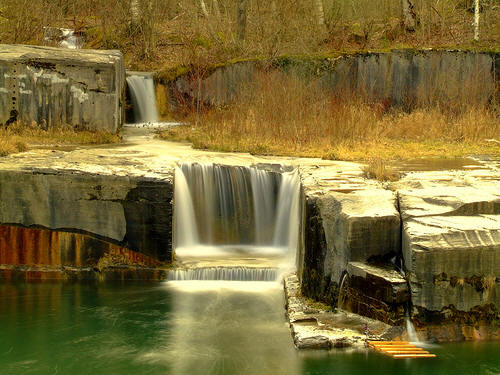
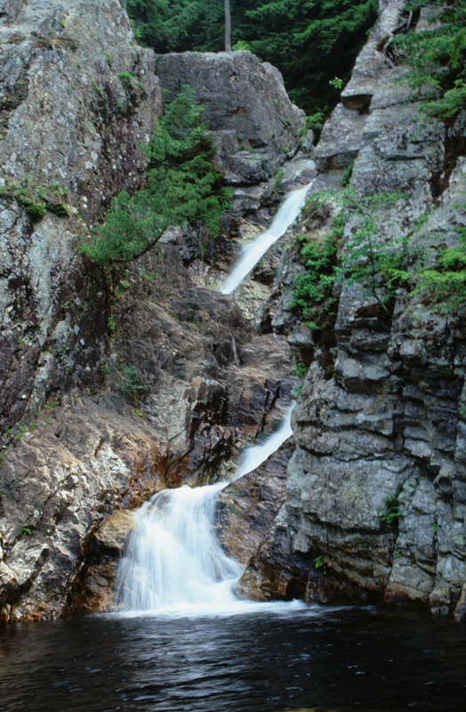
Falls of Lana in Salisbury:
http://www.newenglandwaterfalls.com/waterfall.php?name=Falls%20of%20Lana
This beautiful waterfalls
drops 100 feet. There is an upper and a lower falls and a short hiking
trail to reach the falls. See Map of Branbury State Park on Route
53 near Lake Dunmore:
http://www.vtstateparks.com/pdfs/branbury.pdfu and
http://www.vtstateparks.com/pdfs/branbury_trails.pdf
Also
http://www.newenglandwaterfalls.com/waterfall.php?name=Falls%20of%20Lana
and
http://www.northeastwaterfalls.com/waterfall.php?num=128&p=1 and
http://www.moosalamoo.org/FallsofLanaandSilverLakeTrails.asp


