| |
|
 |
|
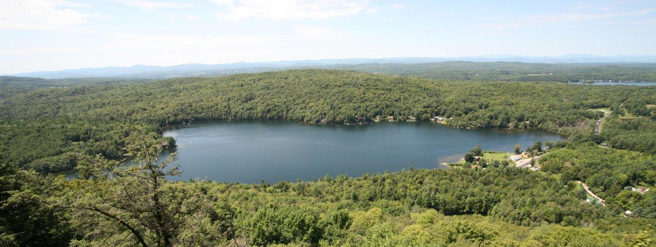
Beebe Pond from Eagle Rock |
| |
 |
|
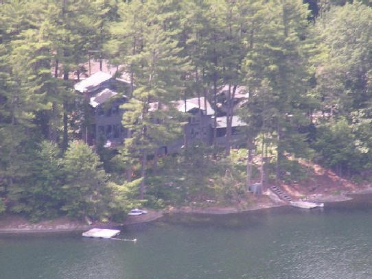
Eagle Rock east of Beebe Pond |
| |
 |
|
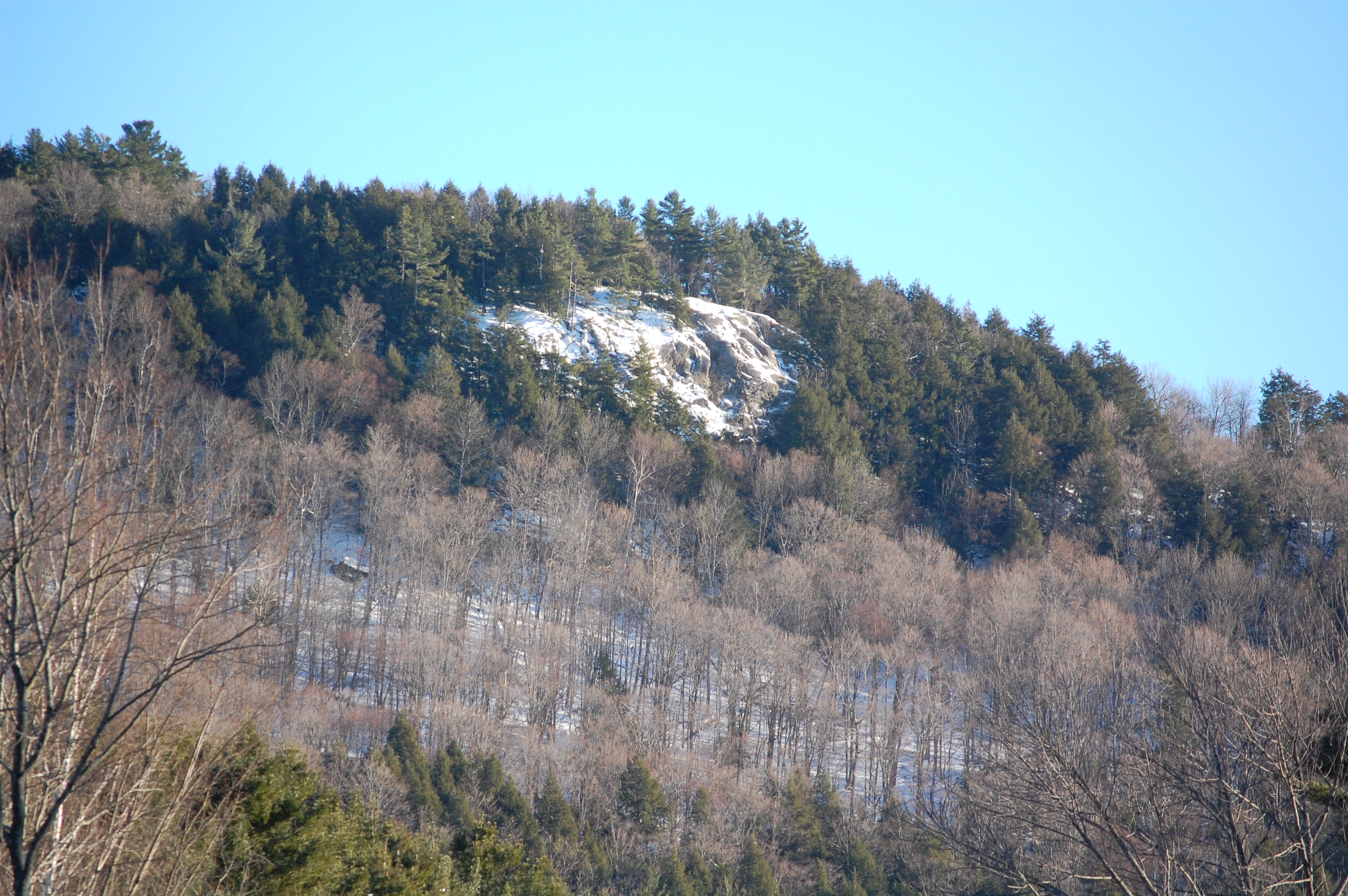
Eagle Rock December 2010 |
| |
 |
|
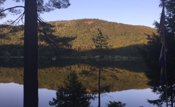
Eagle Rock July 2015 |
| |
 |
|
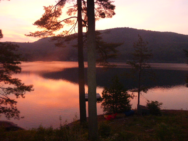
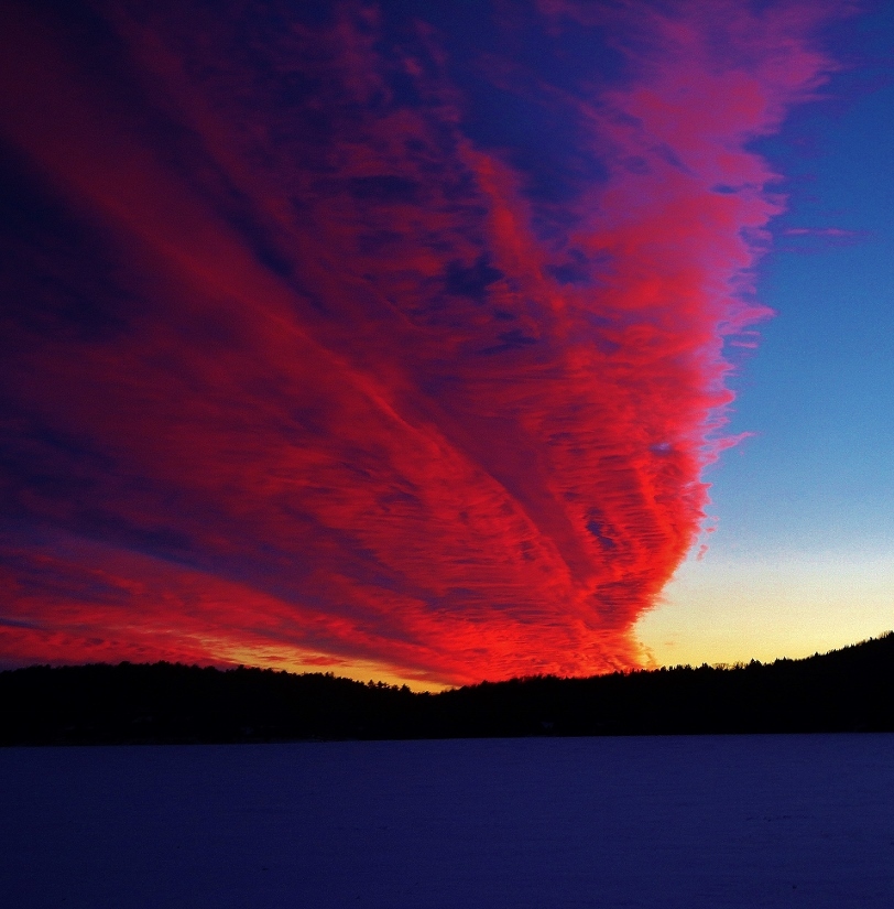
Sunrise: September 2015 |
| |
 |
|
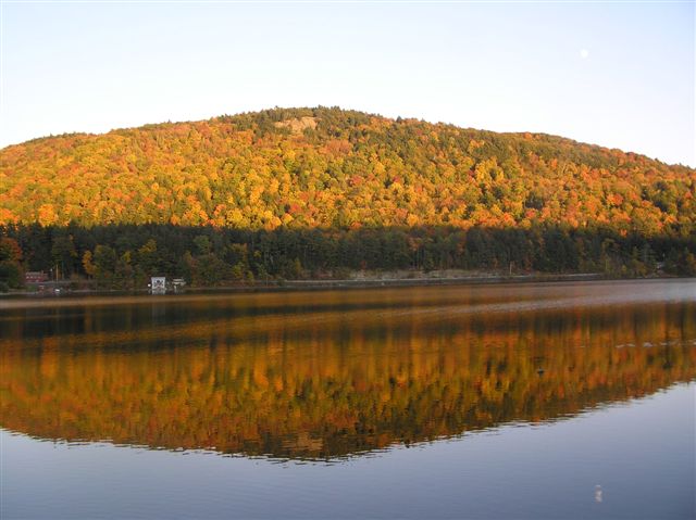
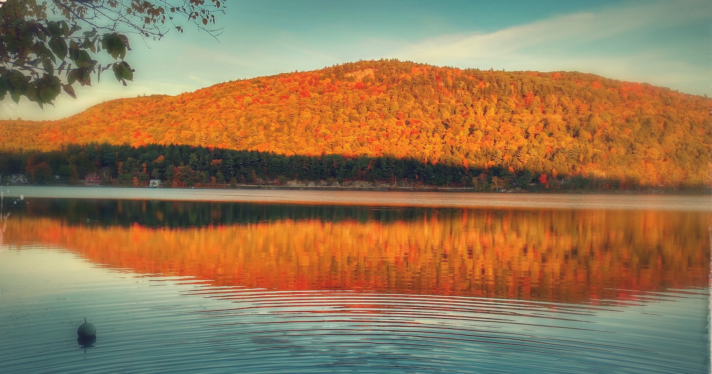
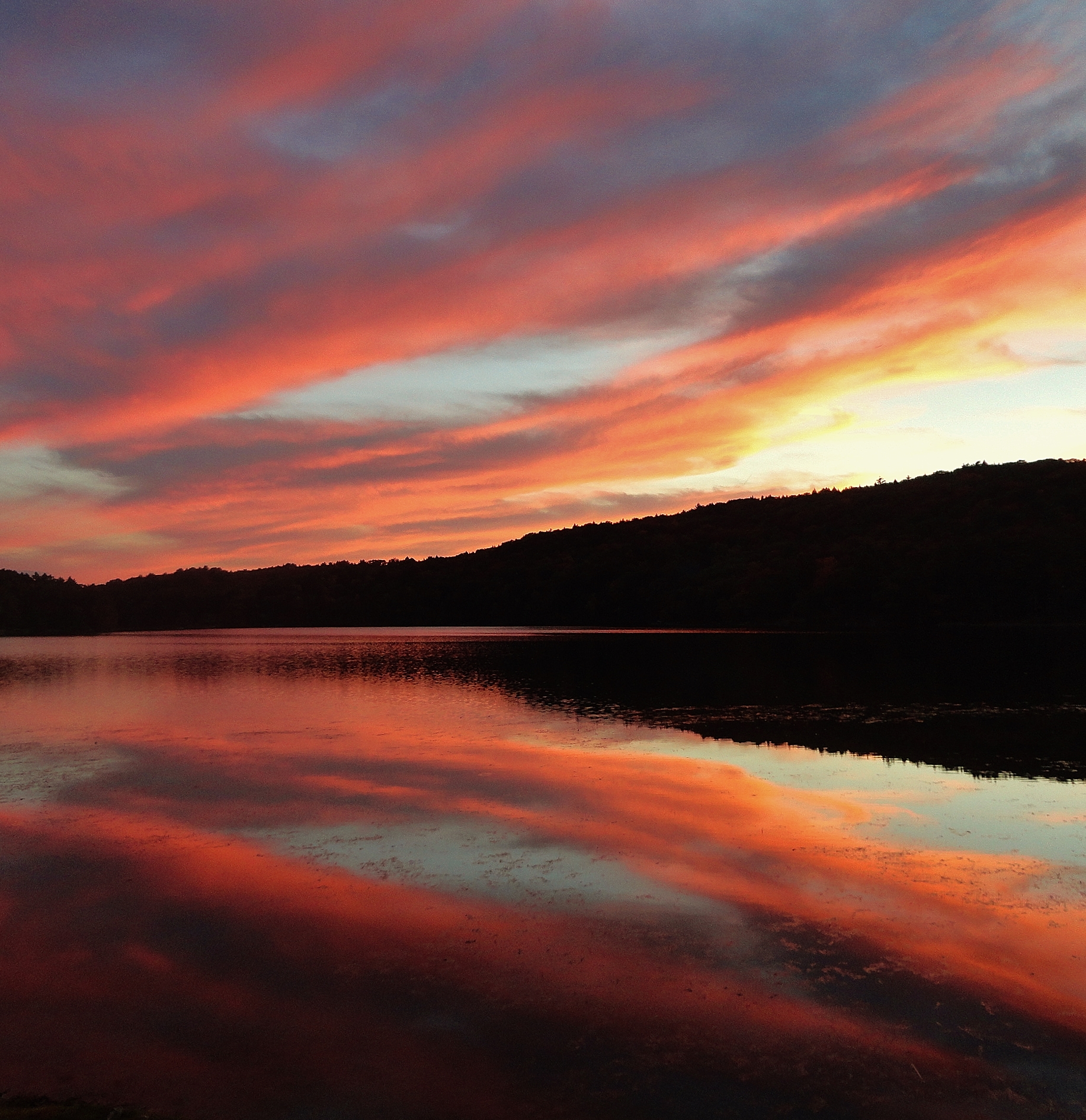
Autumn in Vermont: October 2015
|
| |
 |
|
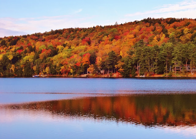
June 2016 |
|
 |
|
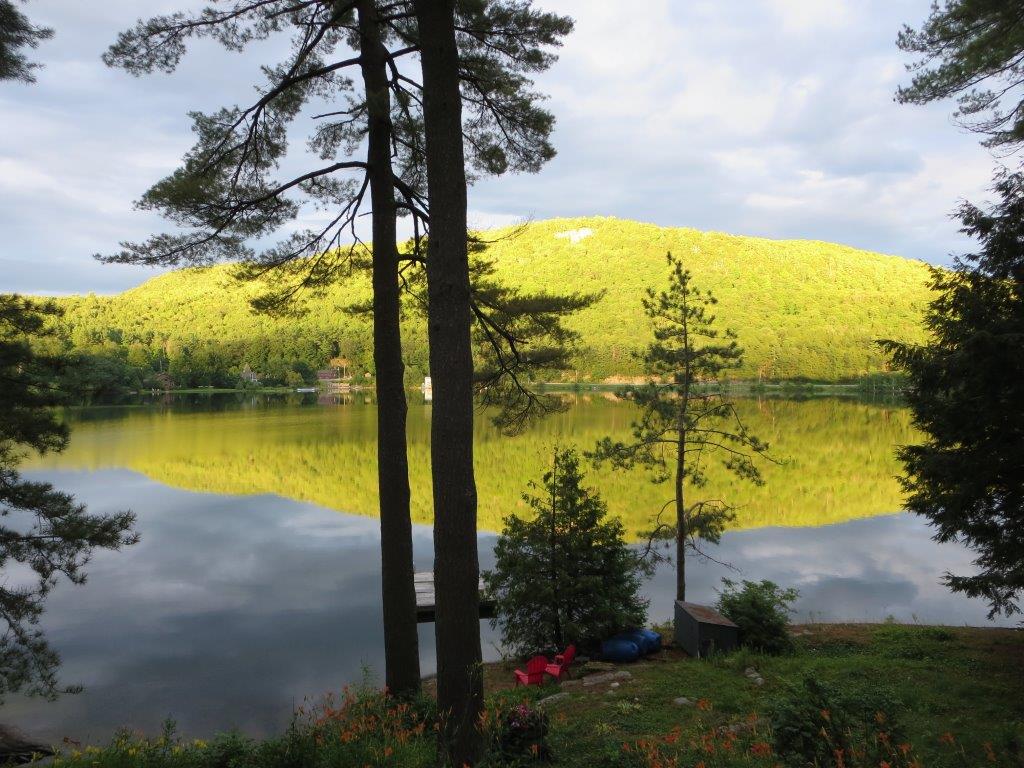
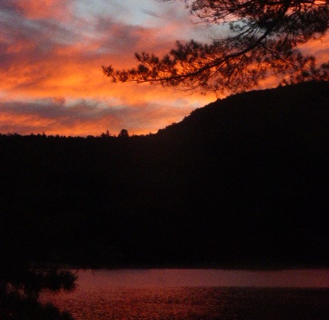
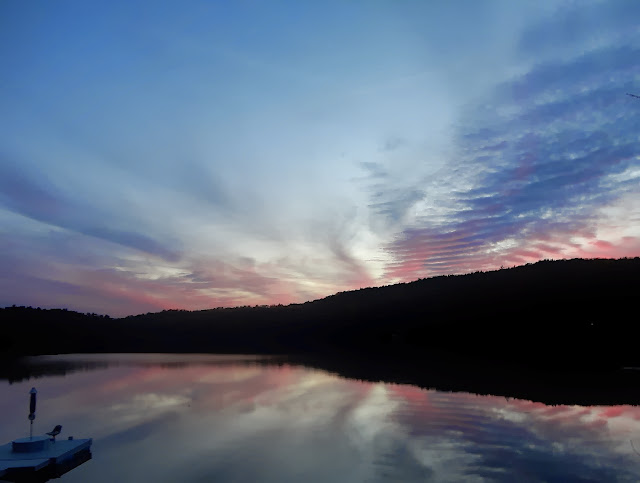
Sunrise: August 2016 |
 |
|
Don & Mary's Sondergeld Home on Camp Awanee's
"Senior Hill" |
|
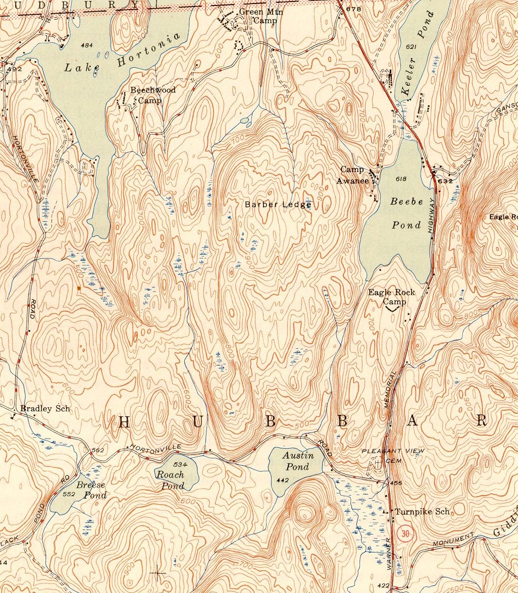
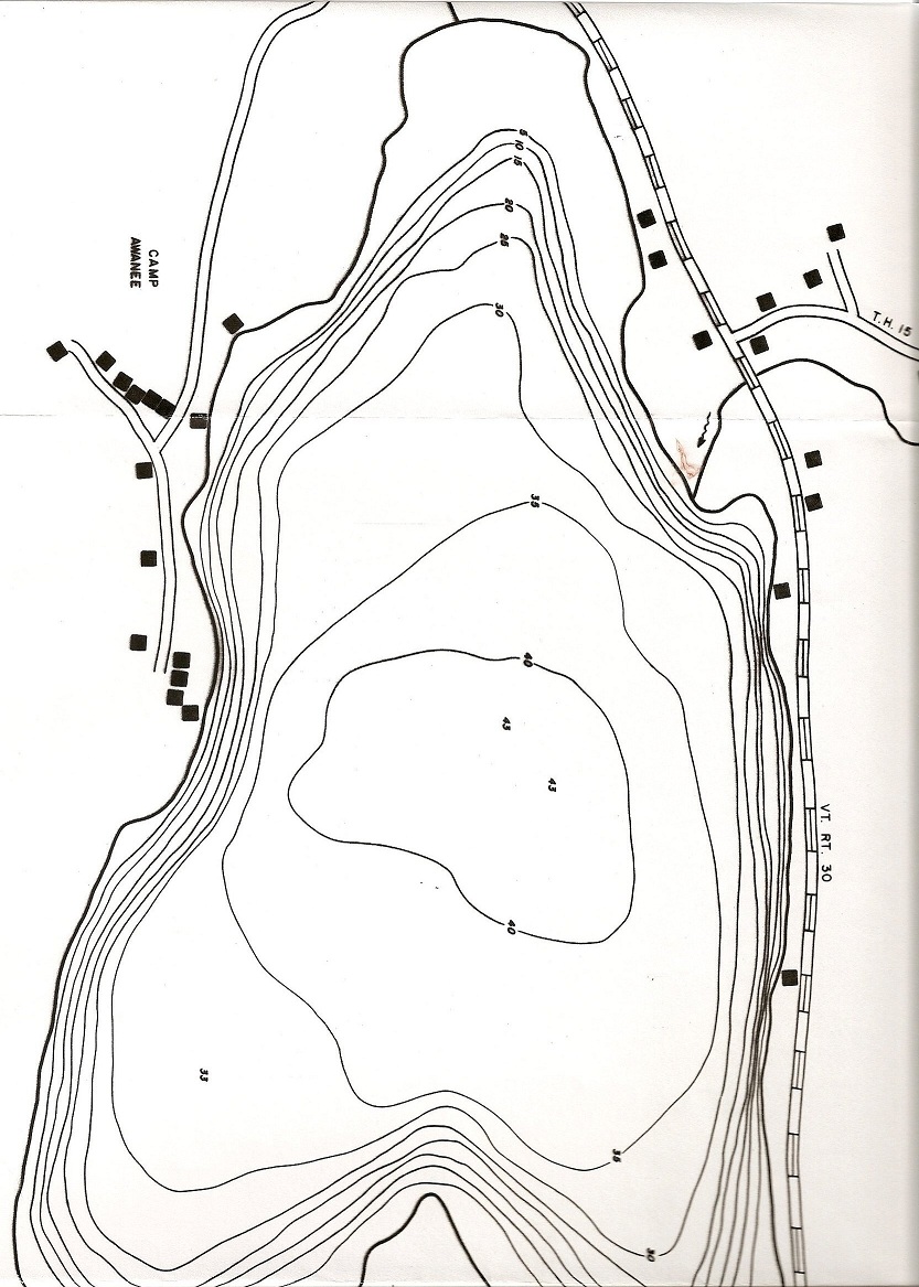
BEEBE POND
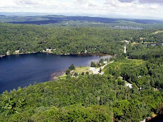
Beebe Pond (Lake Beebe) is a beautiful 110 acre lake located
in the Town of Hubbardton in Rutland County in Vermont. See
map
http://www.anr.state.vt.us/dec/waterq/lakes/docs/depthcharts/lp_beebehubb.pdf#zoom=100
The deepest part is
43 feet deep. Beebe
Pond flows into Austin Pond and then into Lake Bomoseen.
Water from Lake Bomoseen goes through a channel into the
Castleton River in Hydeville.
The Castleton River ends at the Poultney River in Fair Haven. The
Poultney River empties into the East
Bay of Lake Champlain, near Whitehall, New York. Here is a
1946 topo.
In 1965 June Sherline sold a
lot to the Vermont Fish and Game Department with
100 feet of waterfront for
parking and access to Beebe Pond from Route 30. This
public access has not yet been developed for ease of access.
There are many lots around Beebe Pond. If you
want to know who owns the various lots around Beebe
Pond and how much lake frontage they own, in feet,
click here.
-
POTS
OF GOLD
 |
|
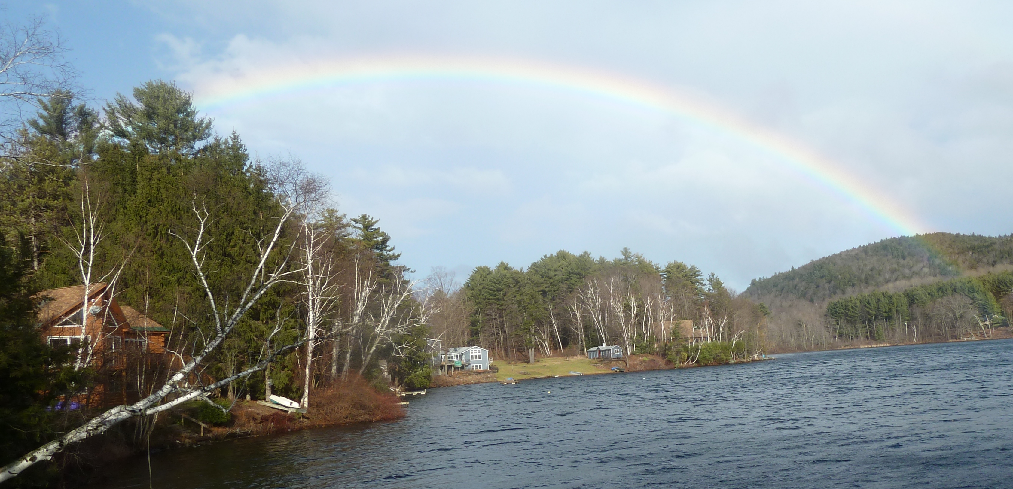
Steve Buser found two
Pots of Gold. Joe Wolons picture on 10/29/2010.
|
| |
|
 |
|
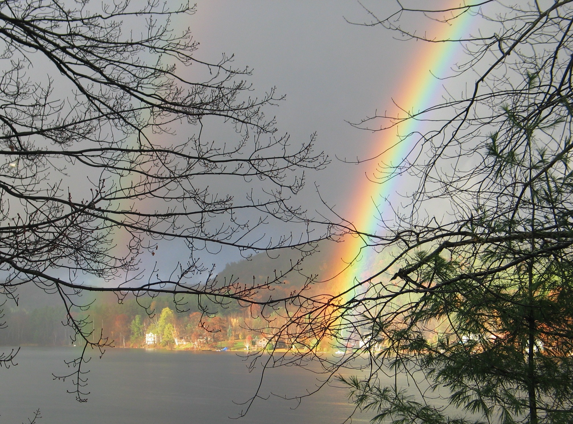
Another "Regenbogen" on December 22, 2012 at
Beebe Pond. No snow. |
VORTEX
AT SUNSET AND MORE
EAGLE ROCK
ESTATES - HISTORY
For almost 50 years there were a number of beautiful
summer camps for children on Echo Lake, Beebe Pond, and Lake Hortonia. The
three main cities the campers came from were: N Y City, Montreal, and
Philadelphia. June Sherline owned Twin Lake Camp on Echo Lake and
Camp Awanee on Beebe Pond. She subsequently sold Twin Lake Camp,
but in 1964 she subdivided the Camp Awanee property into building lots
on Beebe Pond. She called the subdivision: Eagle Rock
Estates.
Here is some History. See
Summer Camps.
FIRST
HOUSES IN EAGLE ROCK ESTATES
Eagle Rock Estates on Beebe Pond was developed in the mid 1960's after
Camp Awanee closed.
In 1964 there was one house in Eagle Rock Estates: that of June
Sherline, who owned Camp Awanee.
Her caretaker, Al Greeley of Sudbury, became the foreman or general
contractor for those that wanted
homes built or existing camps remodeled. Al did grading, put in
septic tanks, and used Fred Fortier of
Fair Haven to do the carpentry work. A few of the existing camp
buildings were remodeled. Current owners are: Mason (June
Sherline's house), Rollman (Infirmary) , Doherty (Counselor's Bunk),
Boudreau (Storage Building), and Cooley (Shower House). The first new
house was the Gallagher's, built in 1965. Houses built in 1966
were: Sondergeld, Ranhofer, Al Fleming (now Holland), and Walker
(now Mullen).
We bought our property on Beebe Pond in 1965. See
Sondergeld Property.
A list of the
dates of purchase of lots in Eagle Rock Estates
is a proxy for the dates the original houses
were built shortly thereafter. Here is a map and a location of
houses in 1989.
Here is
a
phone list of people that provide services to those that now
own homes.
Telephone service originally meant a
four party line.
CAMPS ON
BEEBE POND & ECHO LAKE
Read about the history of these
summer camps. Also
see Summer Camps.
The Twin Lake Camp and Camp Awanee web site is at
http://www.twinlakecamp.com/ A
listing of
Camp Awanee Alumni is at
http://www.twinlakecamp.com/index.php?page=index&sub=alumni&class=unknown
Read about
Gus, the Canada Goose.
Listen to songs made in 1947 by campers from Camp Awanee,
the
girl's camp , and from
Twin Lake Camp, the boy's camp
.
Here are many
pictures of Camp Awanee
on Beebe Pond, plus a few of Twin Lake Camp on
Echo Lake.I have
added some
history, drawn a better map, and added a few more pictures of the
location of the various
buildings
in Camp Awanee,
with valuable input from Ilyse Segal, a former Camp
Awanee camper from Montreal and Doug Nagy who worked
at Camp Awanee as a teenager..
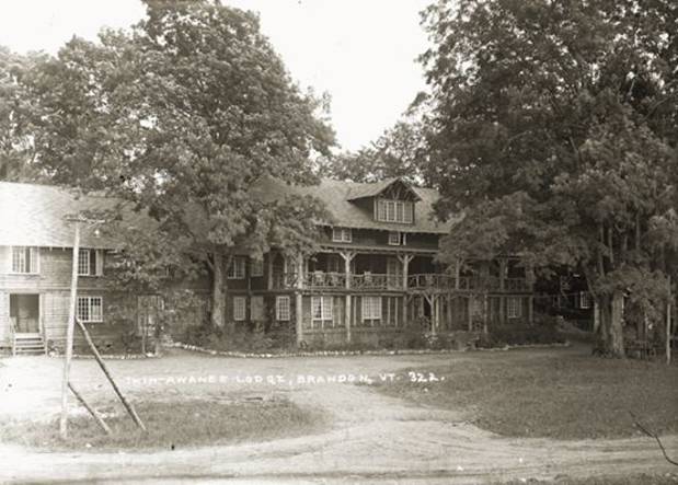
TWIN AWANEE LODGE
It was located across from Diamond Brook Kennel on
property that subsequently became Camp Echo. The property was
later subdivided into five properties with frontage on Echo Lake.
Here are a some pictures.
CAMPS ON LAKE HORTONIA
Learn about the history of the two
summer camps on Camp Road.
Originally there were two camps: Green Mountain Camp for Boys on
Camp Road relatively close to Route 30 and Green Mountain Camp for Girls
at the west end of Camp Road.
The boy's camp was closed and then reopened as a
girl's camp called Wanee. It was closed and vacation homes
are now located there. The camp buildings are in Hubbardton and the
waterfront is in Sudbury. The name of the girls camp was changed to Camp
Birchwood and after it closed, was reopened as a boy's camp which is
currently operating as Camp Wachusett.
Info on Camp Birchwood is at:
http://www.facebook.com/pages/Hubbardton-VT/Camp-Birchwood-Lake-Hortonia-Hubbardton-VT/295497644606
and at
http://www.facebook.com/group.php?gid=45483461516
and
Camp Wachusett began in NH. That camp was closedand the name was
moved to the new Vermont location. Our grandson, Zach Principe,
has had a terrific time at Camp Wachusett in 2011, 2012,
2013 and is again a Counselor in 2014.. Info on Camp
Wachusett is at
http://www.facebook.com/pages/Hubbardton-VT/Camp-Wachusett/208186020737
and at
http://www.campwachusett.com/
TURTLE CLUB
A swim club, mostly ladies, has been in effect for many years on Beebe
Pond.
Members and friends swim from the west
to the east side of Beebe Pond and back at 7:30 am every morning from
sometime in June to sometime in September, depending on the water
temperature.
To become a member, one must participate in the 7:30
am swim three times. New members are awarded a small turtle pin.
The Club was organized in 1986.
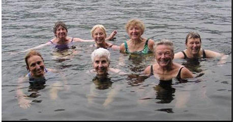
The old guard consists of:
Joanne Zeoli, Anne Holland, Barbara
Dellamonte, Barb Cooley
Florence Mason,
Beverly Grald, Mary Sondergeld
The
“Turtles” say: “Beebe Pond is shaped like a turtle, thus our name
Others say: “The pace of
the swim is like the speed of a turtle.”
Read
"The Turtle Tale". a terrific
story and view pictures by the eminent artist and writer Florence
Mason.
Camp Awanee Turtle Pins

EAGLE ROCK RACQUET CLUB
This tennis club is located on
Delancey Road near Beebe Pond. There are 12 families that own
stock in Eagle Rock Racquet Club: 8 from Beebe Pond, 3 from Echo Lake
and 1 from Lake Bomoseen.
Its History.
LAKE BEEBE
WATERSHED ASSOCIATION (LBWA)
"LBWA" is a State of Vermont non profit corporation
formed in 2001 as Twin Lakes Watershed Association. It was granted
501C3 tax exempt status by the IRS in 2004. Its name was
changed on December 9, 2015.
Read its By Laws, as amended on December 9, 2015.
Tax deductible contributions can be made to this
organization. LBWA's major project in 2016 coordinating the placing
the chemical, Sonar, in the lake to kill Eurasian Milfoil, raise the
money for this expensive endeavor. Anyone can join this lake association. To see a list of the
members from 2013 thru 2016, click here.
Don Sondergeld was elected a Director of LBWA along with 6 other
new Directors on July 5, 2014. Later that month Don was elected
President. Bob Ranhofer was elected Vice President. Amy Kullgren was elected Secretary and also Treasurer.
LBWA will handle the administration of the milfoil control project
beginning in 2015 for Lake Beebe. The Echo Lake Property Owners
Association will continue to handle the administration of controlling
milfoil on Echo Lake. Tax deductible contributions can be made to
any one of three separate funds in LBWA: General, or Lake Beebe, or Echo
Lake.
The purpose of "LBWA"
is to:
1. maintain, conserve, protect and enhance the environmental health, quality and
purity of the water constituting the bodies of water generally known as
Beebe Pond or Beebe Lake in the Town of Hubbardton and Echo Lake in the
Towns of Hubbardton and Sudbury in the State of Vermont (collectively
"Twin Lakes") and their tributaries, located within such Towns
("Tributaries") (the area covered by and within a mile immediately
surrounding the Twin Lakes and their Tributaries is hereunder
collectively referred to as "The Watershed
Area")
2. maintain, conserve, protect and enhance the health quality, and beauty of the
flora, trees and other plant life located in the Twin Lakes Watershed,
3. foster and develop the appreciation and enjoyment by residents and
non-residents of Vermont of the beauty and environmental quality of the
Watershed Area, and
4. engage in and encourage activities of a scientific, literary or charitable
nature involving or incidental to the foregoing.
Mary Sondergeld has been the State of Vermont's Lay Monitor,
involved in measuring the quality of Lake Beebe since 1978.
In 2010 she was honored with a certificate from the State as
Lay Monitor of this state owned lake for 32 years, a record of
more years than any other monitor in the state of Vermont. Barb Cooley then
became the Lay Monitor for Lake Beebe until 2015 when the gavel was
passed to Keith Brostek.
Mary Sondergeld also began writing Grant applications
in 1994 for
the Town of Hubbardton to submit to the State for milfoil control
on Lake Beebe. After 18 years, she passed the grant writing
gavel to Karla and David Principe in
2012. Andrew Moran wrote the Grant for 2016. and 2017.
Although the State of Vermont owns
an access
to the lake from route 30 just south of the Mosesson's property,
it has not yet been developed.
In
1971 Don Sondergeld and others petitioned the State
of Vermont to ban the use of combustion engines
on the lake. A compromise was reached, although the use of
combustion engines was not
banned. In 1973 the State imposed two rules: a 5 mph
speed limit and a maximum horsepower of 10. See a listing of
rules for each lake in Vermont and a listing of
special rules for
certain lakes.
See
https://youtu.be/sigtD4kgLyM
Lake Beebe outlined by its watershed


LAKE BEEBE PROPERTY OWNERS
ASSOCIATION (LBPOA)
The owner of Eagle Rock Estates, June
Sherline, asked Don Sondergeld to set up a Property Owners Association
to deal with road maintenance. This
Association was formed on September 1,
1968. The
first officers and directors were: President: Don
Sondergeld, Vice President: Art Greiner, Secretary: Alan Breckenridge,
Treasurer: Frank Lane, Directors: Ken Gallo, June Sherline, Al Tillman,
and Joe Wolons. Although the private access roads in Eagle Rock Estates
were owned by June Sherline, she had no intention of maintaining the
roads, so this property owners association collected money for
maintaining these private roads. During the years
this was an unincorporated association, Don served as President,
Secretary, Treasurer, and Road Commissioner.
The Association was incorporated in
1981 in order to own the
roads to property in Eagle Rock Estates
and
4.1acres of land surrounding the outlet at the SW end of the
lake. These two properties were deeded to
it by June Sherline:
the two miles of roads on 8.07.1981
and the 4 acres of land at the southern outlet to the lake on
9.03.1981. Here
are the deeds.
The new incorporated association
(LBPOA) held its first meeting on August 8, 1981. It is a State of
Vermont "not for profit" corporation, but it is not a 501C (3) federally
tax exempt organization.
It would not qualify as a 501C(3) as such an
organization's assets must be permanently dedicated to an exempt
purpose. A separate 501C(3)
organization, Lake Beebe Watershed Association (LBWA) was set up in 2001
that enables tax deductible contributions be used for lake the control
of milfoil.. See LBWA above.
LBPOA's main activity has been maintaining the private
roads it now owns around the lake. It assesses members and non members
that use its roads for road maintenance and for snow plowing.
Road Maintenance was its primary function, with
little involvement in protecting the lake. However, in 1984 Eurasian
Milfoil became an issue and LBPOA was involved in administering
projects, both sonar and suction harvesting. In 2015 "Anti M" a
barge used in suction harvesting and associated equipment was sold to
LBWA in 2015 and that organization now administers milfoil control
projects on Lake Beebe.
IMary Sondergeld was President from 2006 -
2009. Officers elected in 2015 are: Karla Principe President,
George Osmun Vice President, Rebekah Brostek Secretary, and David Principe Treasurer.
In 2016 John Moran became President.
About 70 property owners, of which 66
have homes, that
have a legal access to Lake Beebe are eligible to join this
Property Owners Association. LBPOA no longer publishes
a Membership List.
Here is a list of property owners that are eligible to join..
Membership dues have been $3. A By Laws change occurred in 2013,
in which those Potential Members that do not pay all applicable
assessments along with their Dues may not vote. The By Laws, as amended in
2016 are here.
The By Laws state the purposes of this Property
Owners Association shall be to enhance, encourage, promote and benefit
the general welfare of Lake Beebe and its surroundings.
However, the major purpose has always been to fund the maintenance
of the private roads that it owns.
On July 5, 2014 the Members 0f
LBPOA voted to transfer some of its assets to Lake Beebe Watershed Association and voted that LB WA administer the milfoil
control project on Lake Beebe. In 2015 $10,000 was donated by LBPOA to LB WA. Another
$10,000 was donated by LBPOA to LBWA in 2016. The money remaining in
LBPOA's Lake Fund, about $5,000 will also be donated if there is no
remaining tax liability on that Fund. This amont will be determined
after Federal and State Income Tax
problems are resolved.
Like many other property owner
associations, about 50% of those property owners join.
In 2009, only 50% of those properties eligible to join had Members. In
2012 55% of eligible properties had at least one individual
membership. However, only 39% of properties that had memberships paid $6
to have two individual memberships and the other 61% only paid $3.
Also, none of those property owners on Route 30 are asked to help fund
the private road maintenance so there is little reason for their
joining.
| Location |
Eligible Properties (Homes) in 2013 |
|
Birch Road
|
35 |
| Columbia Drive |
16 |
| State Route 30 |
15 |
| Total |
66 |
"NEARBY" SHOPPING FROM BEEBE POND
|
Location |
Stores |
Directions |
Miles |
| Rutland
Center |
Everything |
Rt 30
south to Route 4A east |
23 |
| Rutland
South |
Everything |
Rt 30
south to Route 4 east |
23 |
| Brandon |
Grocery,
Gas, Hardware, Restaurants |
Rt 30
north to Route 73 or |
12 |
| Brandon |
Grocery,
Gas, Hardware, Restaurants |
Rt 30
north to Burr Pond Rd to Long Swamp Rd |
8 |
|
Middlebury |
Almost
Everything |
Rt 30
north |
20 |
| Fair
Haven |
Grocery,
Gas, Hardware, Restaurants |
Rt 30
south to Route 4 west
or |
15 |
| Fair
Haven |
Grocery,
Gas, Hardware, Restaurants |
Rt 30
south to Route 144 west to Rt 22A south |
17 |
|
Castleton Center |
Grocery
, Diner, Pizza, Gas, Bank |
Rt 30
south to North Road south |
10 |
|
Castleton Corners |
Gas,
Grocery, Dunkin Donuts |
Rt 30
south |
10 |
|
Castleton West |
Hardware, Lumber, Auto Parts, Grocery |
Rt 30
south to Rt 4A west |
12 |
| Route 30 |
Pumpkin
Patch Grocery |
Rt 30
south |
4
|
| Orwell |
Grocery,
Gas |
Rt 30
north to Rt 73 west |
10 |
POPULATION OF HUBBARDTON AND ITS
NEIGHBORS (Annual Estimate)
| Orwell
1247 |
Sudbury
549 |
Brandon
3828 |
| Benson
1028 |
Hubbardton 690 |
Pittsford
2879 |
| Fair Haven 2633 |
Castleton
4595 |
West Rutland 2229 |
http://www.vermont-demographics.com/cities_by_population
HUBBARDTON, VERMONT
Don published a 200 page book titled History of Hubbardton
Vermont in October 2005. He sold 100 copies in 10 days, ordered
130 more and sold 50 by Christmas 2005. He reprinted 260 copies of
a revised
208 page
book in July 2007.
Cover (Use 50% size)
Inside of Back Cover
Here is a Driving Tour "Brochure" Don Developed of
Historic Hubbardton. In 2013 Don started the process
to get Hubbardton Battlefield designated a National Historic Landmark.
See my
8.13.2013 Letter of Inquiry
to the Department of Interior and my
8.26.2013 letter to Governor Shumlin of Vermont.
Vermont has less than 1% of hese designations (less than .9 of 1% in
the National Register and less than .7 of 1% of NHLs.)
Listings in the National
National Historic
Register of Historic Places
Landmarks
Vermont
814 (.009)
17 (.007)
Grand Total
90,575 (.991)
2,517 (.993)
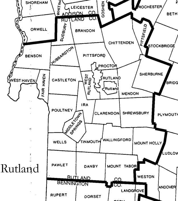
Hubbardton, in Rutland County,
abuts four towns: Castleton to the south, Benson to the west, Sudbury to
the
north, and Pittsford to the east. Areas, see:
http://libraries.vermont.gov/sites/libraries/files/html/townareas.htm
Hubbardton no longer has a post office.
Five post offices deliver mail to five areas: Castle to the southeast,
Brandon to the northeast, Orwell to the northwest, Fairhaven to the
southwest, and Bomoseen to those on Route 30 almost as far north as
Birch Road at Beebe Pond.
The following describes Hubbardton, the four towns it abuts (Sudbury,
Benson, Castleton, and Pittsford), plus Brandon, Fair Haven, and
Orwell.
Hubbardton: It is the site of a small battle, a
delaying action, that took only a few hours on July 7, 1777 in East
Hubbardton as American General St Clair was fleeing from the British
after abandoning Ft Ti.
This was the only Revolutionary War battle that occurred on Vermont
soil.
http://www.revolutionaryday.com/usroute4/hubbardton/
For 45 years there were a number of summer camps for
boys and for girls located in Hubbardton. Hubbardton never had a
traffic light and it has no crossroad. Hubbardton no longer has a
school or post office. Mail is delivered to Hubbardton by five
post offices: Bomoseen to Route 30, Castleton to the SE corner, Fair
Haven to the SW corner, Orwell to the NW corner, and Brandon to the NE
corner.
Some info on the towns that provide mail
service to Hubbardton and those that abut Hubbardton is shown below:
Post
Offices
Benson:
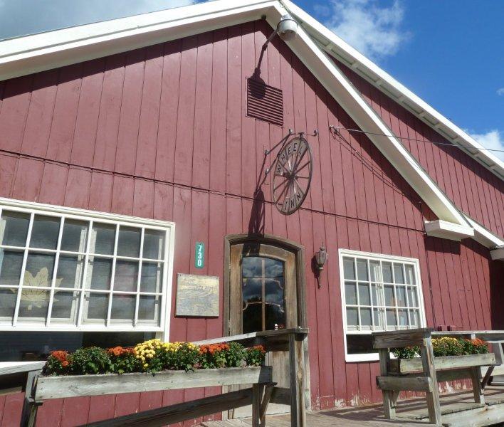
You must visit our western neighbor and dine at the Wheel Inn
which is open for three meals
a day seven days a week. You
will enjoy the food, the prices, the service and the people that dine
there.
http://www.yelp.com/biz/the-wheel-inn-restaurant-fair-haven
Benson is also known for its annual Burdock Festival and Fishing
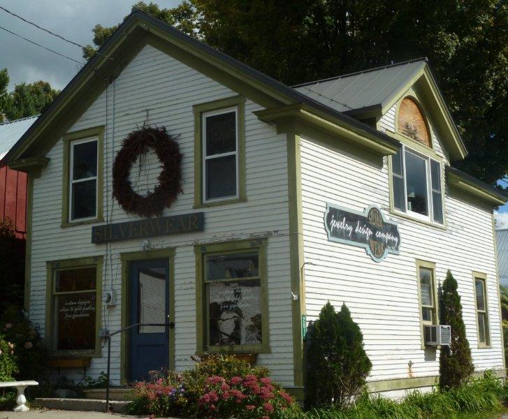
Derby as it is on Lake Champlain. Be sure to visit Benson Village
Store, Silverwear, and the Book Shed.
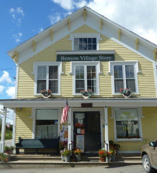  
Benson Village Store
Silverwear Jewelry
Wheel Inn Restaurant
Rufus Wilmot
Griswold was born on February 13, 1815 and raised as a strict
Calvinist
in the hamlet of Benson.
He was the
twelfth of fourteen children. His father was a farmer and shoemaker.
In 1822,
the family sold the Benson farm and moved to nearby
Hubbardton
on the road to
Whitmore's Grist Mill. His
parents died in Hubbardton but are buried in the Mountain View
Cemetery in Orwell, Vermont. His mother Deborah, died in
July 1860 at age 85 and his father Rufus, died in August 1862
at age 89.
As a child,
Griswold was complex, unpredictable, and reckless. He left home when
he was 15, calling himself a "solitary soul, wandering through the
world, a homeless, joyless outcast".
Griswold moved to
Albany, New York,
to live with a 22-year-old flute-playing journalist named George
C. Foster, a writer best known for his work New-York by Gas-Light.
Griswold lived
with Foster until age 17, and the two may have had a romantic
relationship. When Griswold moved away, Foster wrote to him begging
him to return, signing his letter "come to me if you love me".
Griswold
attempted to enroll at the Rensselaer
School
in 1830, but was not allowed to take any classes after he was caught
attempting to play a prank on a professor. Griswold was married
three times.
He built a reputation as a literary critic, becoming known for his
savagery and vindictiveness.
Griswold and
Edgar Allan Poe were not friends. Edgar Allan Poe (January 19,
1809 – October 7, 1849)
died at age 40. Griswold died of tuberculosis 8 years later
at age 42. He is buried in Green -Lawn
Cemetery in Brooklyn, NY.
http://en.wikipedia.org/wiki/Rufus_Wilmot_Griswold
http://www.eapoe.org/geninfo/poegrisw.htm
and
http://www.eapoe.org/papers/misc1827/nyt49100.htm
http://www.hrc.utexas.edu/educator/modules/poe/arguing/
and
http://www.poeforward.com/poe/texts/griswold-poe-obit.html
http://www.poeforward.com/poe/griswold.html
and
http://www.library.vanderbilt.edu/speccol/mss/griswoldrw/griswold-rufus.shtml
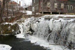
Brandon: Famed 19th century statesman Stephen
A. Douglas, the "Little Giant" was born in Brandon in 1813. His
birthplace is now the Brandon Museum as well as the town's Visitor
Center.
The
most important industry ever carried on in town, which contributed most
extensively and permanently to the growth of the town, was the iron
industry established by John CONANT.
In 1820 he built the first blast-furnace in town.
The establishment of the Brandon Training School in
1915 was a significant event, providing many employment opportunities
forarea residents. At its height, the Training School served over 600
Vermont residents.
There are three ways to get to Brandon. Use the
Burr Pond Road
which us much shorter than route 73.
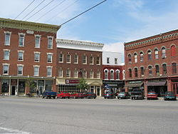
Brandon's historic downtown with its entire core of 243
buildings is listed on the National Register of Historic Places. The
Governor has called Brandon: The Art and Soul of Vermont.
Brandon resident
Warren Kimble,
Liza Myers,
Judith Reilly
and others, have contributed to making Brandon a great place
to experience art in the state of Vermont. The biggest
festival of its kind in Vermont is held in July each
year, the Basin Bluegrass Festival. Dine at Cafe Provence and
the Brandon Music Cafe. Drive by the beautiful homes on Park
Street.
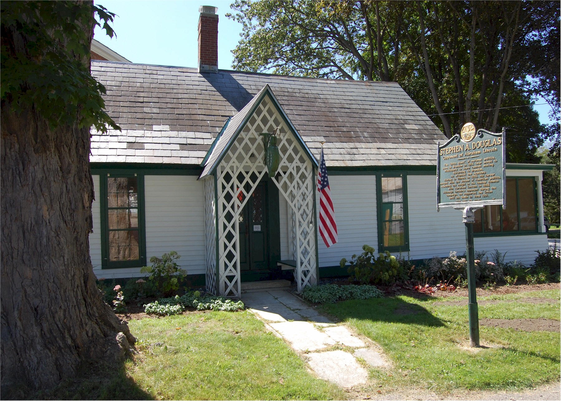 
Stephen Douglas Birthplace
Falls on Neshobe River
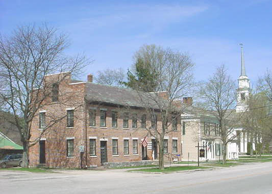
Castleton:
In May 1775
Ethan Allen, Seth Warner, Edward Mott, John Brown and
Benedict Arnold and a force of about 250 American troops encamped
here at the farm of Richard Bentley.Ethan
Allen met with
Benedict Arnold
to plan their next day's attack on
Fort Ticonderoga,
on the New York side of
Lake Champlain.
The site of the meeting is marked by a large stone
between the Birdseye Diner and the congregational church.
) Their
successful capture of the fort was a holding action that lasted two
years until the British launched a powerful sweep southward on Lake
Champlain.
After the loss of Fort Ticonderoga and Mount Independence in July 1777,
Fort Warren was built and became a part of a string of
forts built across the state for the defense of Vermont. It was located
on less than three acres in Castleton from 1777 to 1779, roughly on the
NE corner of Rt 4A and the East Hubbardton Road. See more details under
Vermont History..
Castleton is known for the mile-long tree-shaded Main Street,
with its array of
Federal
and
Greek Revival
style houses and public buildings, many by designer builder Thomas
Royal Dake. Birdseye Mountain, is named
for Colonel Bird. He had acquired 40 shares of land when the town was
chartered. He built a permanent residence there in the summer of
1769. The railroad came in 1854, and the last half of the century saw
the development of tourism around Lake Bomoseen. Several luxury hotels
were built around the west end of the lake. A trolley system ran from
the center of town to Lake Bomoseen, a popular place for tourists
vacationing during the summer. The Hydeville area flourished in the
mid-19th century as a slate quarrying and milling center. Have breakfast
or lunch at the Birdseye diner. Everyone must read
"The Blue Cat of CastleTown".
Purchase it at The Castleton Village Store.
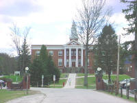
Castleton State College,
the oldest college in Vermont, is the 18th oldest college in the
US. Castleton Medical College, established in 1818,
has roots that go back to October 15,
1787.
http://www.csc.vsc.edu/glance/collegehistory/index.htm
Higley House See
https://www.castletonvermont.org/home/pages/higley-house

Erastus Higley built the Higley House, called the
“Homestead” by family members, during 1810 and 1811. Five generations of
Higleys lived here and it was next door that Zeruah Higley Guernsey
Caswell, Erastus’ niece, created the “Caswell Carpet” which now hangs in
the Metropolitan Museum of Art, New York.
Read about the
Blue Cat of
Castleton and
reviews. See
http://digital.library.upenn.edu/women/coblentz/cat/cat.html
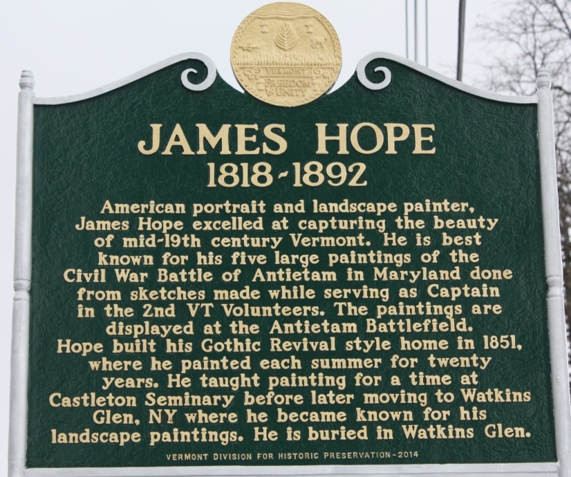
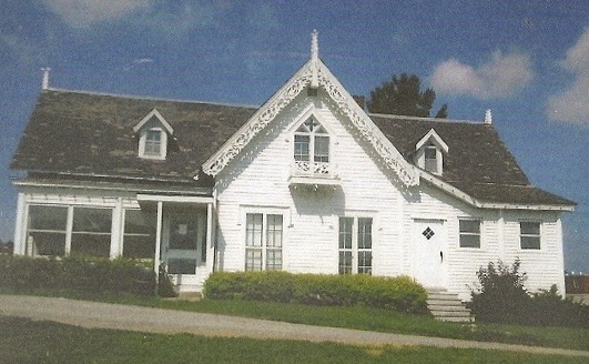
Pope House and Jame Pope (shown below on
South Street ) Read about artist James Pope at
https://vermonthistory.org/documents/findaid/hope.pdf

Pond Hill Ranch in Castleton (802-468-4669) has Trail Rides.
See:
ttp://www.pondhillranch.com/
Barrel Races are on Tuesday evenings and Rodeos are held on Saturday
nights.
Fair
Haven: In 1792 Fair Haven's size was reduced when West
Haven was split off into a separate town. FairHaven is noted for
its
Victorian architecture,
considered some of the finest in the state.
In 1783,
Colonel
Matthew Lyon
moved to Fair Haven and began building
mills
at the
falls
on the Castleton River. His enterprises included a
gristmill,
sawmill
and
paper mill,
in addition to a
forge.
This began Fair Haven's legacy as a small, prosperous
mill town,
which by 1859 included a
marble
mill,
rolling mill,
nail factory,
paper mill producing
wall paper,
three sawmills, a
wagon
shop, a
machine shop,
two
blacksmith shops,
and twoshoe
shops. The
quarrying
and manufacture of
slate
began in 1846.
Orwell:
Mount Independence
on Lake Champlain, across from Fort Ticonderoga, was the largest
fortification constructed by the American colonial forces.
The fort was being built at the direction
of Continental generals Schuyler and Gates when word came that the
Declaration of Independence had been signed, so it was named Fort Mount
Independence in honor of that fact.
http://en.wikipedia.org/wiki/Mount_Independence_(Vermont)
In the 1870s, several young men were lost in a thresher accident.
The community banned industrial farming
later that year in a special town meeting. Industrialized farm
equipment was only allowed back into Orwell after the economic collapse
of the early 1900s, and even then, special restrictions were placed to
limit the capabilities of such farm instruments. The town's law against
the use of "Modern Farm Machinery of All Kinds" was never actually
repealed, and continues to be a curio law on the books that the town
refuses to repeal.
Orwell attempted in the late
1990s to obtain a franchised fast-food restaurant, as a vital link in
the food availability between
Whitehall, New York,
and
Vergennes, Vermont,
but the residents of the surrounding townships blocked the
move, claiming it would upset the rural beauty of the western Vermont
countryside.
Orwell
is known as the Fortress of America. The town motto is 'First in
Revolution, First in Recreation' .
Be sure to visit the woodcarver,
Norton. See
http://www.nortonsgallery.com/
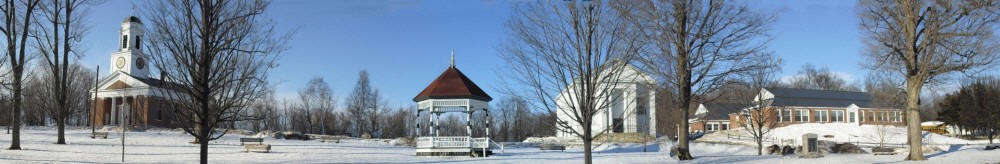
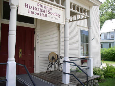
Pittsford:
The town was named for
William Pitt ("the Great Commoner").
Two historical picket
forts
used by the
militia
during the
American Revolutionary War:
Fort Mott
(built in 1777), and
Fort Vengeance
(built from1780 to 1781), about a mile north are in Pittsford.
This neighbor of Hubbardton to the east has no
paved road from Hubbardton. The Biddie Knob Road from Monument Hill
Road, near the East Side Fire Station, over Pittsford Ridge is no
longer open, making Pittsford a neighbor that is not easily
accessible.
 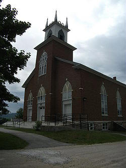 
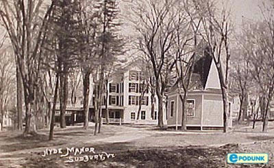
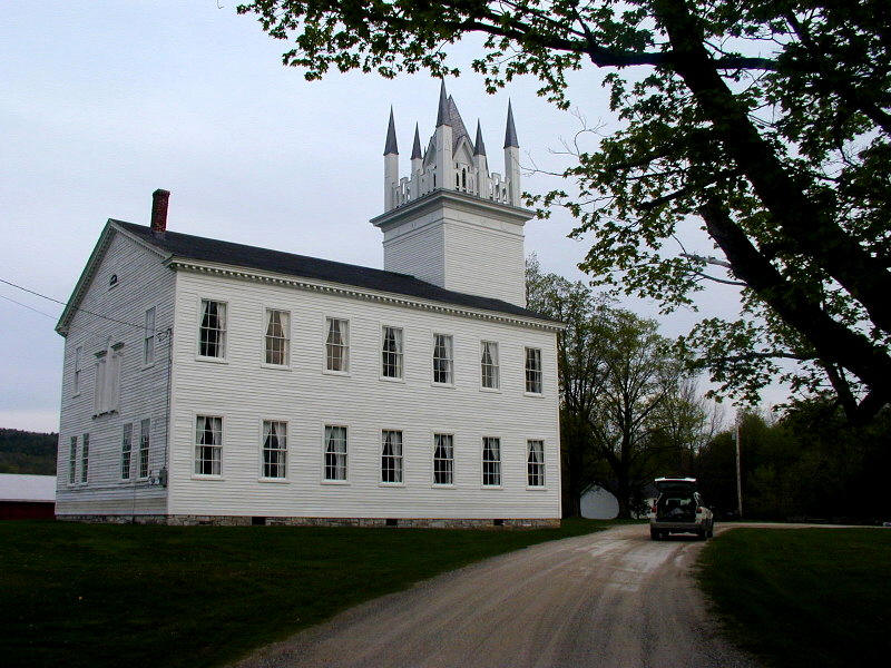
Sudbury: Known for the famous
Hyde Manor, the beautiful Congregational Church, and the
Vail House. http://forum.treasurenet.com/index.php?topic=174060.0
The "History of Hubbardton Vermont" was published in 2005.
Don had his second history book printed in September 2011. The new
book is "History of Sudbury Vermont". Here is the
Front Cover (Sudbury Meeting House)
Back
Cover (Hill School) and
the
Book.
Read about Cecile Preseau and
The Horseshoe Dance
Hall
constructed from lumber from the Dining Hall at Canp Awanee on
Beebe Pond. Visit Trevin Farm on Willowbrook Road. You will love their
wonderful purebred Nubian goats.
http://www.trevinfarms.com/
Read about the Vail House in Sudbury. Also
see
https://www.rootsandrecall.com/blog/bratton-brick-house-vail-house-alike/
We have stayed at Seon State Park at the Seyon Lodge, in Groton VT.
Perhaps there is a connection between the owners of the Vail House in
Sudbury and the "Vail" owner of Seyon Lodge.
RUTLAND COUNTY (1 of 14 in
Vermont)
The map below shows where the
Town of Hubbardton is located in Rutland County. It shares borders
with Castleton to the south, Sunbury to the north, Benson to the west
and Pittsford to the east. It has postal service from five post offices:
NE is from Brandon, NW is from Orwell, SW is from Fair Haven, SE is from
Castleton, and most of State Rt 30 is from the Castleton Post Office
called "Bomoseen" at Castleton Corners. It has no schools, but
owns part of the Elementary School in Castleton. Most of its
students go to High School in Castleton.
BEEBE POND and HUBBARDTON
GULF
The Hartford (CT) Ski Club had a
lodge near the single chair lift at Mad River Glen. As a member, I
learned to ski there, but it was a long drive from Hartford. When
my buddies and I got to Granville Gulf we would stop the car and hoot
and holler as we were almost there.
After Mary and I bought property
at Beebe, I knew we were almost there as we were going through a
gulf, which I called Hubbardton Gulf. I submitted a petition to
the State of Vermont to name the area of Rt. 30 south of Beebe
Pond: Hubbardton Gulf. That name was approved in 1975.
An October 16, 1975 article in
the Rutland Herald was titled Hubbardton-At Last-Has a Gulf of Its
Own.
It now joins a select few "Gulfs" in Vermont:
Proctorsville, Northfield, Williamstown, and Granville.
The Ottawa Citizen had a short article on Vermont's
Gulfs dated June 20,1959:
http://news.google.com/newspapers?nid=2194&dat=19590620&id=80sxAAAAIBAJ&sjid=deQFAAAAIBAJ&pg=5695,1204372
Put your cursor on the Ottawa Citizen page to scroll.
Below is a 1946 topographical map of the area: http://docs.unh.edu/towns/VermontTownList.htm
ROCKS
Don loves rocks, but Don is not a Michael Grab. See
http://twistedsifter.com/2013/01/rock-balancing-art-by-michael-grab/
and also
https://www.bing.com/images/search?q=balancing+rocks+by+michael+grab&id=F566A37C8EB37EC1D4DDDEBB00B5471B285D80A8&FORM=IQFRBA


| 
